Home
June 8, 2022 2025-02-26 11:24Home
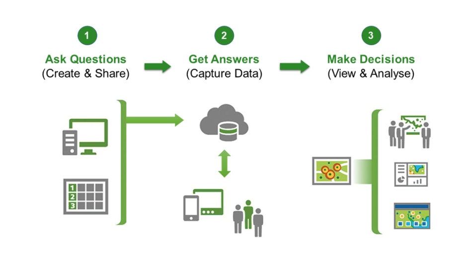
Simplify your data collection efforts with ArcGIS Survey 123
 Rachael Mutuli
 December 5, 2022
ArcGIS Survey 123 is a fast and easy way to gather outdoor survey data. Survey123 helps you collect data in…
Read More
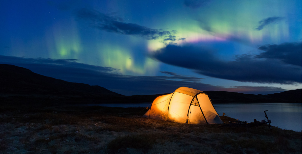
How GIS can be used to better plan your next camping trip
Rachael Mutuli
November 29, 2022
Whether you’re a parent or a camper, one thing’s for sure: your next camping trip is going to be amazing!…
Read More

Become a successful GIS analyst

As a GIS analyst, you’re at a unique point in your career. It’s exciting, challenging, and as vital to the…
Read More
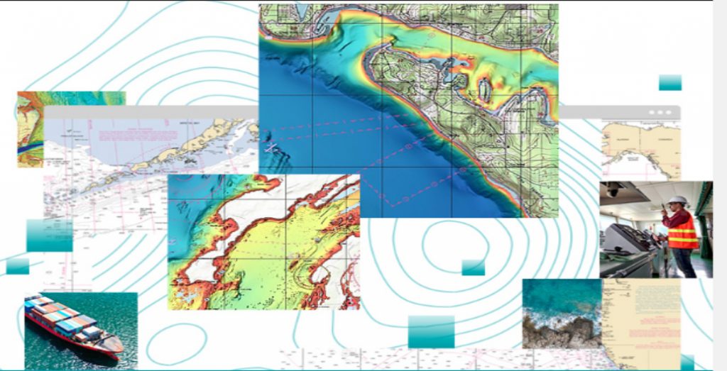
ArcGIS Maritime Extension – making marine data accessible!
ArcGIS Maritime Extension provides SQL capabilities, as well as topological tools to effectively process data from over ten thousand vector…
Read More
Five tips to get started in GIS
Rachael Mutuli
November 14, 2022
Here are five tips that can help you get started in Geographic Information System (GIS).
Read More

Propelling organizations to greater heights
Rachael Mutuli
November 2, 2022
How good is your location? Is it time to kick your agency into high gear? With Geospatial Intelligence, you can…
Read More
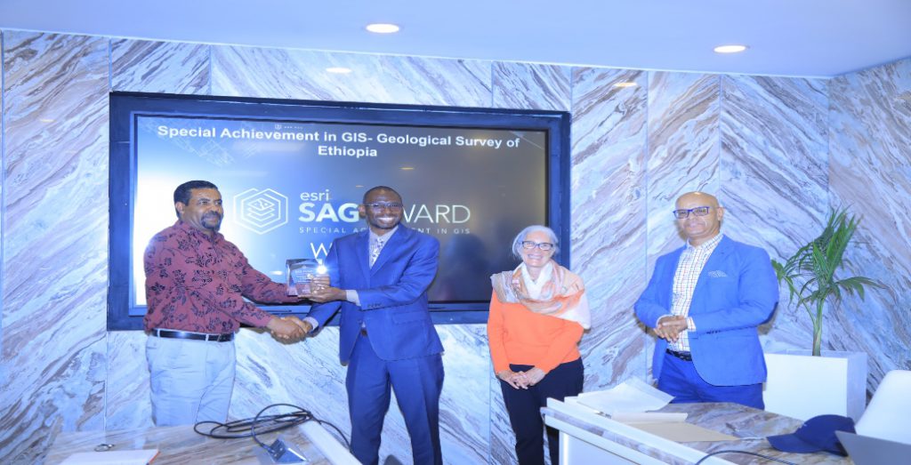
And the Special Achievement Award in GIS Goes To…GSE!
Rachael Mutuli
November 1, 2022
Geological Survey of Ethiopia (GSE) was awarded the 2022 Special Achievement Award in GIS during the Esri User Conference in…
Read More
 Powering Data Online
Rachael Mutuli
October 31, 2022
Powering Data Online
Rachael Mutuli
October 31, 2022
Members of the group used Esri technology to create an ArcGIS Online organizational account where geographic data from respective organizations…
Read More

Kenyatta University Launches a GIS Lab
Rachael Mutuli
October 18, 2022
With the provision of the license from Esri, Kenyatta University launched a GIS lab to promote knowledge of GIS and…
Read More

Buy Online!
Rachael Mutuli
October 18, 2022
To stay competitive in this new business and economic environment, requires new strategies and practices.
Read More

A pillar of research!
Rachael Mutuli
October 17, 2022
The University embraced use of GIS in teaching and Research in 2012 and has successfully become a GIS lighthouse with…
Read More
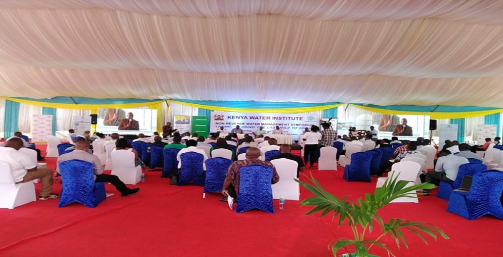
Esri EA exhibits at the non-revenue water management symposium
Rachael Mutuli
October 17, 2022
ater is central to economic and social development. It is necessary for maintaining health, growing food, generating energy, managing the…
Read More

A contemporary strategy for public health readiness
Rachael Mutuli
October 17, 2022
GIS can help public health departments assess their readiness for pandemics and other events by providing them with tools to…
Read More
ArcGIS Desktop Migration
Rachael Mutuli
October 12, 2022
Why you should consider the migration
Read More
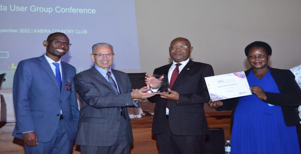
Uganda Bureau of Statistics Bags a GIS Award
Rachael Mutuli
October 12, 2022
The Uganda Bureau of Statistics (UBOS) was awarded the 2022 Special Achievement Award in GIS during the Esri User Conference…
Read More