From Novice to Pro: Build Your Geospatial Skills with ArcGIS
September 21, 2023 2023-09-21 11:41
From Novice to Pro: Build Your Geospatial Skills with ArcGIS
Geospatial technology plays a crucial role in analyzing and visualizing spatial data for a wide range of industries and applications. ArcGIS is one of the most widely used geographic information system (GIS) software platforms available today. Whether you’re a beginner or an aspiring GIS professional, ArcGIS offers a comprehensive set of tools and resources to help you build your geospatial skills and unlock the full potential of spatial analysis. In this article, we will explore a roadmap to take you from a novice to a pro in ArcGIS.
Related: ArcGIS for Schools – Empowering the Next Generation of GIS Professionals
Roadmap to take you from novice to pro
Here is a roadmap to help you become proficient in GIS:
Understanding the basics: Getting started with ArcGIS
Before diving into the advanced features of this software, it’s essential to understand the basics. Familiarize yourself with the its interface, explore the different components such as the Catalog, Map, and Geoprocessing windows, and learn how to navigate through the software. Start by creating and managing projects, loading data, and exploring the different types of spatial data formats supported by ArcGIS.
Exploring data and cartography: Mastering the art of map creation
One of the primary strengths of ArcGIS is its ability to create visually appealing and informative maps. Learn about cartography principles, including map design, symbolization, labeling, and color schemes. Understand how to work with different types of data, such as points, lines, polygons, and rasters, and explore the various tools available in the software for data exploration, visualization, and querying.
Spatial analysis: Unleashing the power of GIS
Spatial analysis forms the core of GIS, enabling you to derive meaningful insights from spatial data. Dive into the world of spatial analysis in ArcGIS, starting with basic operations like overlaying, buffering, and proximity analysis. As you progress, explore more advanced techniques such as spatial interpolation, network analysis, geostatistics, and spatial modeling. Gain hands-on experience by working on real-world projects and practice combining multiple analysis techniques to solve complex geospatial problems.
Related: What is Spatial Data?

Geodatabases and data management: Organizing and managing your data
Efficient data management is crucial when working with geospatial data. Learn about geodatabases, the spatial data storage format used by ArcGIS, and understand how to create, import, export, and manage geodatabases. Explore different types of data relationships, such as topologies and networks, and learn how to maintain data integrity, update attribute information, and handle data versioning in multi-user environments.
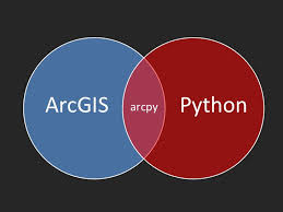
Python scripting and automation: Extending ArcGIS capabilities
Python scripting is a powerful tool for automating tasks, extending ArcGIS functionality, and creating custom tools. Familiarize yourself with the basics of Python programming and understand how to utilize ArcPy, the Python library for ArcGIS. Start by writing simple scripts to automate repetitive tasks, and gradually progress to developing more advanced scripts that integrate with other Python libraries and perform complex geoprocessing workflows.
Related: ArcGIS Python Automation – Streamlining Workflows for GIS Professionals
Web mapping and ArcGIS Online: Sharing and collaboration
AGOL is a cloud-based platform that allows you to create, share, and collaborate on web maps and applications. Learn how to create interactive web maps using AGOL, publish your maps and data, and explore the different ways to share your work with others. Understand the principles of web mapping, including configuring pop-ups, creating custom symbology, and embedding maps into websites and applications.
Related: The Cloud-Based Solution for Geospatial Collaboration
Specialized applications: Exploring industry-specific extensions
ArcGIS offers a range of industry-specific extensions and applications tailored to different sectors, such as environmental management, urban planning, emergency response, and agriculture. Explore the available extensions relevant to your field of interest and gain expertise in utilizing their specialized tools and workflows.
Join our training program and learn more.