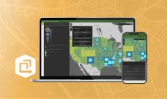
The Cloud-Based Solution for Geospatial Collaboration
September 11, 2023 2023-09-11 7:54
The Cloud-Based Solution for Geospatial Collaboration
In a world driven by data, location intelligence plays a pivotal role in decision-making across various industries. GIS technology has revolutionized the way we understand and interact with spatial data, offering powerful tools for analysis, visualization, and collaboration. ArcGIS Online, Esri’s cloud-based GIS platform, stands out as a versatile and accessible solution that empowers organizations to harness the full potential of geospatial data while fostering collaboration among teams.
Unleashing the power of cloud-based GIS
ArcGIS Online represents a paradigm shift in GIS technology, offering a wide array of benefits for organizations and individuals alike:
Accessibility and scalability
One of the primary advantages of ArcGIS Online is its accessibility. With just an internet connection, users can access geospatial data and applications from anywhere at any time. This level of flexibility is particularly valuable for organizations with distributed teams or those working remotely. Furthermore, ArcGIS Online’s scalability ensures that it can meet the needs of both small businesses and large enterprises, making it an inclusive solution for all.
Collaboration and data sharing
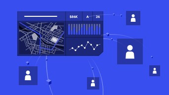
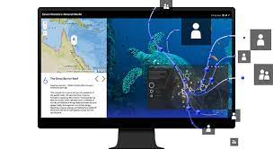
ArcGIS Online excels in facilitating collaboration and data sharing. Users can create, share, and collaborate on maps, apps, and datasets with ease. This feature is invaluable for teams working on projects that require geospatial data, allowing for real-time collaboration, feedback, and decision-making. Whether it’s urban planning, disaster response, or environmental conservation, ArcGIS Online streamlines teamwork.

Map creation and storytelling
Creating compelling maps and stories is a breeze with ArcGIS Online. The platform provides user-friendly tools for designing maps and configuring applications, making it accessible to users of all skill levels. These maps can be used for a variety of purposes, from presenting data to telling engaging stories that drive understanding and action.
Real-time data and analytics
ArcGIS Online integrates seamlessly with real-time data sources, ensuring that users have access to the most up-to-date information. Additionally, the platform offers robust analytics tools for performing spatial analysis, helping organizations make informed decisions based on geographic data.
Security and compliance
Esri places a strong emphasis on security and compliance with ArcGIS Online. Organizations can rest assured that their geospatial data is protected and compliant with industry standards and regulations.
Real-world applications
ArcGIS Online has found its way into numerous industries, transforming the way organizations operate:
- Urban planning: City governments use ArcGIS Online to manage land use, infrastructure, and zoning, facilitating informed urban development.
- Environmental conservation: Conservationists use the platform to track wildlife, monitor deforestation, and protect natural habitats.
- Emergency response: During disasters, ArcGIS Online aids emergency responders in coordinating efforts, visualizing impacted areas, and providing real-time information to affected communities.
- Business intelligence: Retailers and businesses leverage location analytics to optimize site selection, marketing strategies, and supply chain management.
- Education: ArcGIS Online is used in educational institutions to teach students about geography, spatial analysis, and data visualization.
ArcGIS Online is more than just a cloud-based GIS platform; it’s a transformative tool that empowers organizations to collaborate, make data-driven decisions, and create meaningful maps and applications. Whether it’s improving urban planning, conserving the environment, or responding to emergencies, ArcGIS Online provides the foundation for unlocking the true potential of geospatial data in the modern world. With its user-friendly interface and robust capabilities, it’s a game-changer for geospatial collaboration and analysis.