Three Things ArcGIS Spatial Analyst Can Do for You
October 19, 2023 2023-10-19 8:08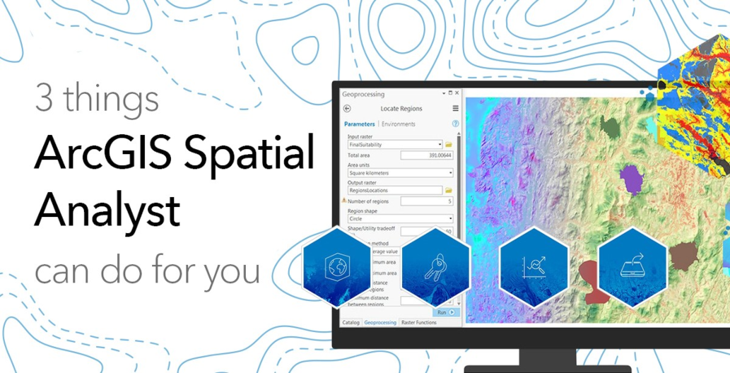
Three Things ArcGIS Spatial Analyst Can Do for You
ArcGIS Spatial Analyst is an extension for ArcGIS Desktop that provides a wide range of spatial analysis and modeling capabilities. Whether you’re a seasoned GIS professional or just getting started with spatial analysis, ArcGIS Spatial Analyst can offer a host of benefits. In this article, we’ll explore three key things that this software can do for you.
Related: 3 Things ArcGIS 3D Analyst Can Do for You
1. Site selection and suitability analysis
One of the primary uses of ArcGIS Spatial Analyst is to perform site selection and suitability analysis. This is invaluable for businesses, government agencies, and environmental organizations looking to make informed decisions about where to locate a new facility, develop a new project, or assess environmental conditions. Here’s how this software helps in this regard:
Multi-criteria evaluation
ArcGIS Spatial Analyst allows you to combine various datasets, such as land use, soil type, slope, proximity to roads, and more, to create a comprehensive suitability model. By assigning different weights to these criteria, you can prioritize factors that are most important for your project and generate suitability maps to identify the best locations.
Cost-distance analysis
This tool enables you to calculate the least-cost path or distance between two locations, considering factors like terrain, travel restrictions, and elevation. It’s crucial for determining optimal routes for infrastructure development, like roads or pipelines.
Hotspot analysis
Spatial Analyst also provides tools for identifying hotspots or areas of concentrated activity. This is essential for businesses looking to find the best locations for their services or stores based on consumer behavior and market trends.
2. Terrain analysis and hydrological modeling
ArcGIS Spatial Analyst offers a robust set of tools for terrain analysis and hydrological modeling. These features are vital for a wide range of applications, from flood risk assessment to landscape design. Here’s how they can benefit you:
Slope and aspect analysis
With the Slope and Aspect tools, you can determine the steepness of the terrain and its orientation, which is valuable for land management, agriculture, and urban planning.
Viewshed analysis
You can assess what areas are visible from a specific point, making it useful for tasks such as sighting cell towers, wind turbines, or surveillance cameras.
Hydrological modeling
ArcGIS Spatial Analyst provides tools for watershed delineation, flow accumulation, and stream network analysis. These are essential for understanding water flow patterns, managing water resources, and assessing flood risk.
Related: Five Powerful Capabilities of ArcGIS 3D Analyst
3. Spatial data transformation and conversion
Another remarkable feature of ArcGIS Spatial Analyst is its ability to transform and convert spatial data into different formats and projections. This functionality is beneficial for professionals dealing with data from various sources and applications. Here’s how it can assist you:

Related: What is Spatial Data?
Data reclassification
You can quickly reclassify data to simplify it for your analysis or to make it compatible with other datasets.
Projections and coordinate transformations
ArcGIS Spatial Analyst allows you to reproject data to ensure that all your layers align correctly and share the same coordinate system. This is crucial when working with data from different sources or when integrating GIS with other applications.
Raster-to-vector conversion
You can convert raster data into vector formats, which is essential for tasks like converting satellite imagery into polygons for land cover classification or creating contour lines from elevation data.
By using ArcGIS Spatial Analyst, you can unlock the full potential of your spatial data, gaining insights that will drive better planning, resource management, and decision-making. So, if you haven’t already, explore the vast possibilities that this software has to offer and elevate your spatial analysis projects to a new level. Click here to explore