3 Things ArcGIS Pro Can Do for You
February 17, 2023 2023-09-04 7:29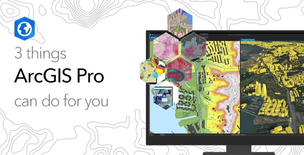
3 Things ArcGIS Pro Can Do for You
ArcGIS Pro has a modern and intuitive user interface that allows users to work more efficiently with maps, data, and tools. It supports 2D and 3D visualization and analysis, allowing users to create and manipulate data in a three-dimensional space.
Some of the key features of ArcGIS Pro include the ability to work with a variety of data types, including raster, vector, and tabular data, the ability to perform advanced spatial analysis using geoprocessing tools, the ability to create and publish web maps and applications, and the ability to collaborate with others by sharing maps and data through the ArcGIS Online platform.
ArcGIS Pro is used by various organizations and individuals, including government agencies, environmental organizations, public utilities, and private businesses, for various purposes such as land use planning, emergency management, environmental monitoring, and natural resource management. It’s a powerful geographic information system (GIS) software application that can perform various tasks and operations.
Related: 3 things ArcGIS Drone2Map can Do for You
Capabilities of ArcGIS Pro
Here are three things that ArcGIS Pro can do for you:
Create and edit maps
ArcGIS Pro allows you to create and edit maps with ease, using a range of data sources, such as satellite imagery, digital elevation models, and other geospatial data. You can add layers, adjust symbiology, and visualize data in 2D and 3D formats to better understand patterns and relationships.
Conduct spatial analysis
ArcGIS Pro provides a comprehensive set of tools for spatial analysis, allowing you to measure distances, calculate areas, and perform complex spatial modeling. This can help you gain insights into spatial patterns, trends, and relationships that need to be visible with basic analysis tools. For instance, you can use ArcGIS Pro to model flood zones, identify areas prone to landslides, or analyze transportation routes.
Collaborate and share data
ArcGIS Pro allows you to collaborate with others and share data in various formats, such as maps, apps, and web services. You can create web maps and apps that can be shared with stakeholders, including your team members, clients, or the public. This can help you make better decisions by gathering feedback and insights from various sources.
Related: Five Powerful Capabilities of ArcGIS 3D Analyst
Overall, ArcGIS Pro provides a wide range of features and capabilities that can help you easily create, analyze, and share geospatial data. Whether you’re a GIS professional or just starting to explore the world of geospatial data, ArcGIS Pro is a powerful tool that can help you achieve your goals.
You can now ArcGIS Pro online. Click here to buy.