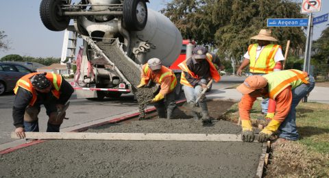
A Spatial Perspective for Resilient, Contemporary and Sustainable Infrastructure
Here's why tackling the life cycle of infrastructure initiatives requires a …

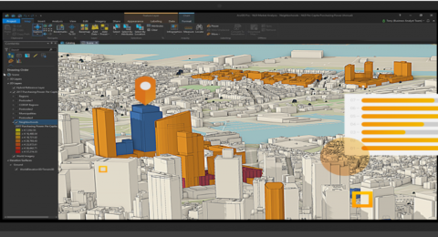
Digitally Transforming the Future Natural Resources
Just as the rest of the world is now beginning to …

Why Teach with GIS?
As the world struggles with complicated issues such as famine, drought, …

Automation of Dynamic Data Updates from Google Spreadsheets
Automation of data is a rising trend in the GIS industry …

Pushing the Boundaries of Geography
While Geography gives you a deeper understanding of today’s most challenging …

What is Spatial Data?
Spatial data, or geospatial data is any piece of information that …

Unleashing Data’s Potential in Banking
With the drastic developments in the banking industry, it's only fair …

GIS Career Suggestions to Help you Land Your Dream Job
If you’re having problems getting your foot in the door for …
Managing, Processing and Analysis of Drone Imagery with Site Scan for ArcGIS
Site Scan for ArcGIS is an end-to-end cloud-based drone mapping tool …

Discover the Digital Mapping Industry: GIS
Despite being unknown, GIS technology is frequently used in our everyday …

What Does a GIS Analyst Do?
A GIS analyst is a hybrid career combining data analysis, cartography …

Turning Drone Imagery to Geospatial Intelligence
Drones are changing how we work in practically every aspect, and …
- 1
- 2