Using Drones for High-Resolution Mapping and Surveying
June 19, 2024 2024-06-19 9:23Using Drones for High-Resolution Mapping and Surveying

In the ever-evolving field of Geographic Information Systems (GIS), drones have emerged as a game-changing technology for high-resolution mapping and surveying. These Unmanned Aerial Vehicles (UAVs) offer unparalleled accuracy, efficiency, and flexibility, transforming how geospatial data is collected and analyzed. Partnering with industry leaders like Esri Eastern Africa and Fahari Aviation, professionals can now harness the power of drones combined with ArcGIS to unlock new possibilities in geospatial intelligence.
Related: 3 Things ArcGIS Drone2Map can Do For You
The rise of drones in GIS
Drones are no longer just a futuristic concept; they are a present-day reality reshaping multiple industries, including agriculture, construction, environmental monitoring, and urban planning. Their ability to capture high-resolution imagery and detailed data from hard-to-reach areas makes them invaluable for GIS applications.
Benefits of using drones for mapping and surveying
Here are some benefits of using drones:
- High-resolution imagery: Drones equipped with advanced cameras can capture incredibly detailed images, providing a level of resolution that traditional methods often cannot achieve. This high-resolution imagery is crucial for accurate mapping and analysis.
- Efficiency and speed: Traditional surveying methods can be time-consuming and labor-intensive. Drones significantly reduce the time required to cover large areas, allowing for faster data collection and processing.
- Cost-effectiveness: While the initial investment in drone technology can be significant, the long-term savings in time, labor, and resources make it a cost-effective solution for many organizations.
- Accessibility: Drones can easily access remote or hazardous areas that might be challenging or dangerous for human surveyors. This capability ensures comprehensive data collection in diverse terrains and environments.
- Real-time data collection: Drones can provide real-time data, allowing for immediate analysis and decision-making. This real-time capability is particularly useful in dynamic situations such as disaster response or environmental monitoring.
Integrating drones with ArcGIS
Esri’s ArcGIS platform is a powerful tool for managing, analyzing, and visualizing geospatial data. When combined with drone technology, ArcGIS enables the seamless integration of high-resolution aerial imagery into GIS workflows. Here’s how:
- Data import and management: ArcGIS allows users to import drone-captured data, manage it efficiently, and integrate it with existing geospatial datasets. This integration ensures a holistic view of the spatial information.
- Advanced analysis: With ArcGIS, users can perform advanced geospatial analyses on drone data. This includes terrain modeling, vegetation analysis, infrastructure monitoring, and more.
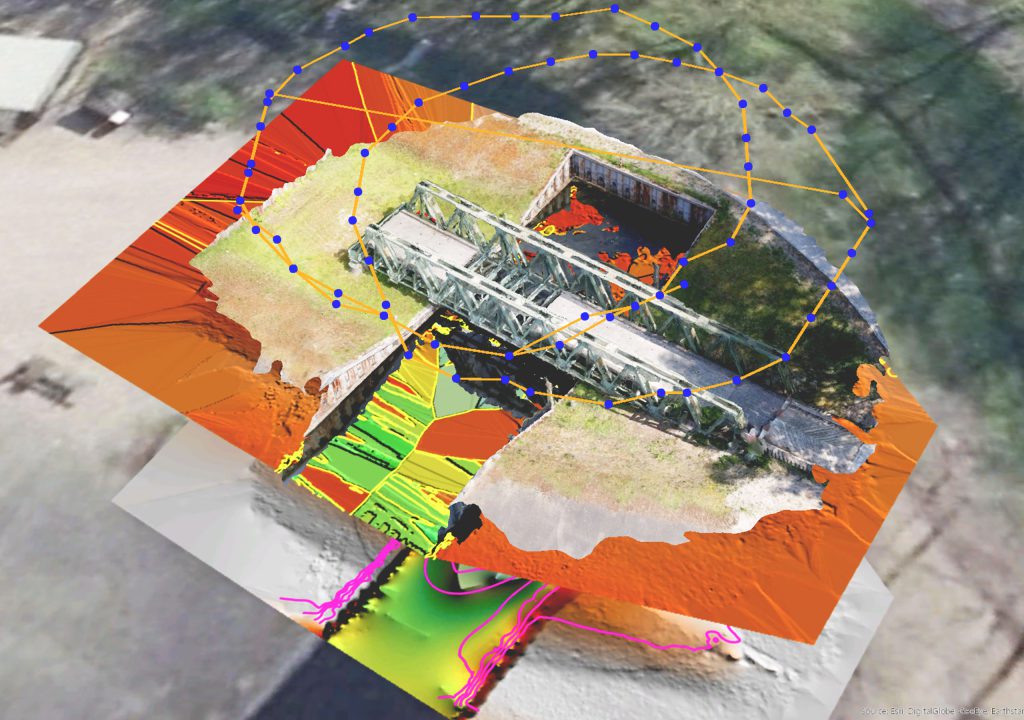
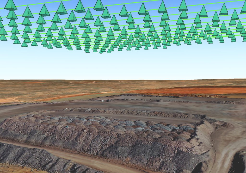
- 3D mapping: Drones provide excellent data for creating 3D maps and models. ArcGIS’s robust 3D capabilities allow users to visualize and analyze the spatial data in three dimensions, enhancing the understanding of complex landscapes.
- Collaboration and sharing: ArcGIS facilitates easy sharing and collaboration. Stakeholders can access and analyze drone data through ArcGIS Online or Enterprise, promoting collaborative decision-making
Related: ArcGIS Drone2Map – Do More With Your Drone Imagery
Fahari Aviation and Esri Eastern Africa
Fahari Aviation, a leading provider of drone solutions, has partnered with Esri Eastern Africa to leverage the full potential of drones in GIS. This collaboration brings together Fahari Aviation’s expertise in drone technology and Esri’s powerful ArcGIS platform, creating a synergy that enhances geospatial data collection and analysis.
The future of GIS with drones
The integration of drones with GIS is just beginning. As technology advances, we can expect even more sophisticated applications, such as autonomous drone missions, real-time data streaming, and enhanced AI-driven analytics. For GIS professionals, staying abreast of these developments is crucial for harnessing the full potential of this transformative technology. Embracing this technology not only enhances current capabilities but also opens the door to future innovations that will continue to transform the GIS landscape.
Discover how drones are revolutionizing high-resolution mapping and surveying—purchase ArcGIS Drone2Map today from the Esri Eastern Africa online store.


