Raster Analysis Using ArcGIS Pro
September 14, 2022 2022-09-14 7:56Raster Analysis Using ArcGIS Pro
Have you ever been stack and stressed out when using more than one software in processing, analyzing and visualizing raster data? This not only wastes time but also affects the speed of your processor with hardware having more than one software which obviously takes up space in your RAM.
ArcGIS Pro is the best GIS desktop software that you can utilize in analyzing vector and raster data. Our product imagery specialists have come in handy to add different tools and extensions in this software. With this software, you may run custom algorithms on big collections of raster data by applying basic raster processing tools and functions, creating new tools and functions, and combining several tools and functions into raster processing chains. Results are archived, automatically published, and distributed.
Because it’s a fast-loading imagery software that enable you to visualize the capabilities from wind/ocean current data to imagery and aerial data from satellite imagery to drone imagery. ArcGIS Pro enables you to fulfill strict project deadlines and constrained budget requirements because of its flexibility in processing and storage capacity.
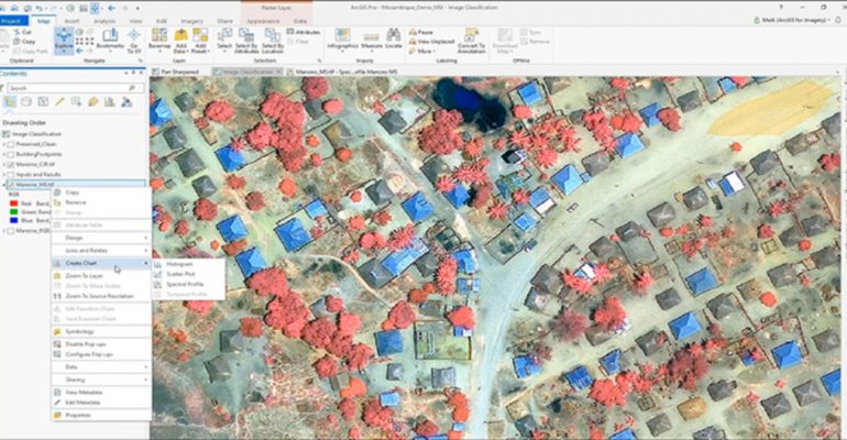
Let’s not forget on the capabilities of raster analysis in 2D and 3D by utilizing raster functions pane. Some of the functions include but are not limited to NDVI Calculation, change detection ,image classification techniques and the newborn ArcGIS Drone2Map functionality.
For instance, if you are interested in land use or land coverage, ArcGIS Pro has many tools that classify imagery. You can choose to classify image pixels or segmented objects using parametric or machine learning classifiers or deploy python raster functions in the python window.
Don’t be left out, try out this software!!
For more info you may contact Esri Eastern Africa products department: products@esriea.com
At Esri Eastern Africa, we provide customers with GIS solutions. Visit our online store https://ea-store.esri.com/en-ke/store/overview to make a purchase


Comment (1)
ArcGIS Desktop Migration – EsriEA | Blog
[…] Find out how you can analyze raster data using ArcGIS Pro […]