Maximizing Efficiency with ArcGIS Field Apps and Mobile Data Collection
August 29, 2023 2023-08-29 8:27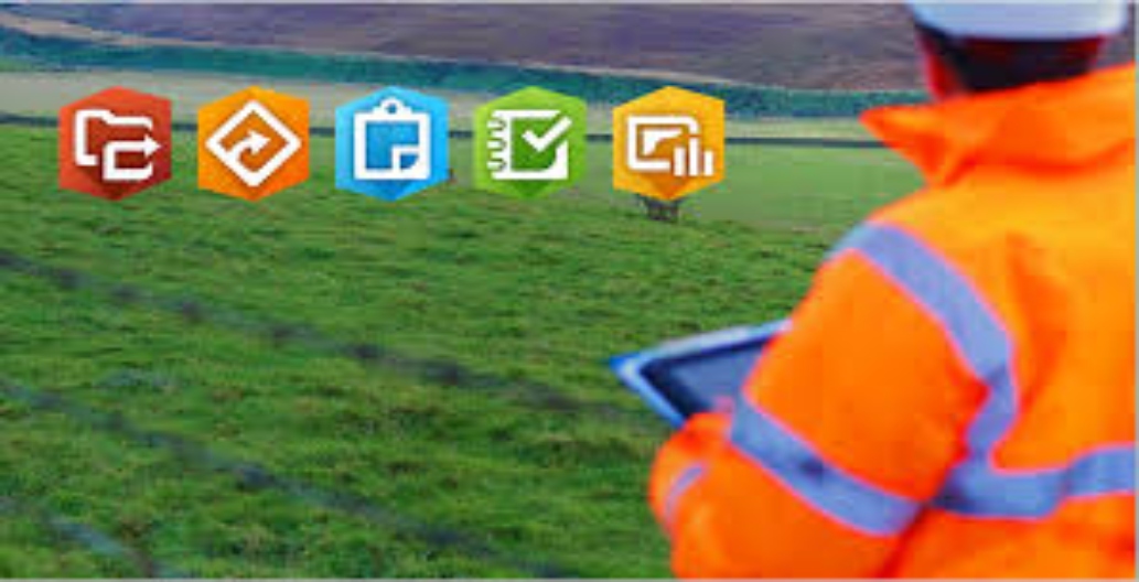
Maximizing Efficiency with ArcGIS Field Apps and Mobile Data Collection
In today’s fast-paced world, organizations across various industries are recognizing the transformative power of mobile technology for data collection and field operations. As geospatial professionals, we always want to be as efficient as possible. There are many ways to get information pertaining to our project and its needs in the field most efficiently. One way is by harnessing the power of ArcGIS Field Apps – a suite of cutting-edge mobile tools that enable efficient data collection, real-time collaboration, and informed decision-making, all while harnessing the power of location intelligence. In this article, we explore how these field apps can revolutionize your operations, streamline workflows, and maximize efficiency.
Related: ArcGIS Navigator: The Ultimate GPS Navigation Solution

How field apps revolutionize operations
Here is how apps can revolutionize your operations:
Empowering field work
Gone are the days of tiresome paper forms and manual data entry. ArcGIS Field Apps bring the digital revolution to the field, empowering your workforce with tools that fit right in their pockets. This Apps include:
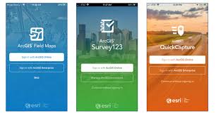
ArcGIS Field Maps: Helps fieldworkers to perform mobile data collection and editing, find assets and information, and report their real-time locations.
ArcGIS Collector: Collector enables workers to gather data with precision and accuracy, capturing everything from asset conditions to environmental observations. The best part? It integrates data into your GIS platform, providing insights back at the office in real time.
ArcGIS Survey123: With ArcGIS Survey123, you can create customized surveys that meet your specific data needs. This tool enables you to collect information effortlessly via mobile devices, tablets, or even web browsers, all while maintaining data integrity and consistency.
Read more: Simplify Your Data Collection Efforts with ArcGIS Survey123


ArcGIS Workforce: Workforce streamlines fieldwork coordination, ensuring that tasks are assigned to the right personnel at the right time. Work orders, inspections, and assignments are managed seamlessly, boosting productivity, and minimizing delays.
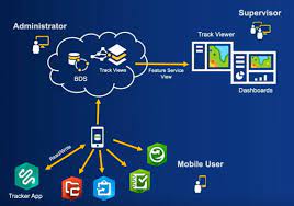
ArcGIS Tracker: Tracker provides a real-time view of field operations by tracking the location of field workers and assets. This not only enhances safety and security but also enables proactive decision-making based on live location data.
ArcGIS Quickcapture: ArcGIS Quickcapture is the quickest method for gathering field observations. With the help of this app, you can easily collect field observations when travelling and scouting potential places, doing aerial surveys, or evaluating damage. It also helps you eliminate the need for manual note-processing time by sending data back to the office for analysis in real time.
Related: ArcGIS Quickcapture
Transforming workflows
The integration of ArcGIS Field Apps into your workflow has the potential to transform the way you operate. This Apps ensure:
Improved accuracy: ArcGIS Field Apps ensure data is captured correctly and uniformly, reducing chances of costly mistakes down the line.
Faster decision-making: Real-time data availability means faster decision-making. Whether it’s adjusting routes for delivery trucks or responding to emergencies, you’re equipped with up-to-the-minute information.
Enhanced collaboration: ArcGIS Field Apps foster collaboration between field teams and office staff. Field workers can instantly communicate changes, report issues, and seek guidance, enhancing overall team efficiency.
Streamlined processes: By eliminating paper-based processes, you cut down on manual paperwork, administrative overhead, and redundant tasks. His translates to more time spent on meaningful work.

A world of possibilities
From utilities and public works to environmental agencies and beyond, ArcGIS Field Apps are versatile tools that cater to a wide range of industries:
Utilities: Streamline maintenance tasks, monitor assets, and respond to outages swiftly.
Construction: Track progress, manage resources, and ensure projects stay on schedule.
Environmental management: Monitor natural resources, conduct surveys, and assess habitat conditions.
Emergency response: Coordinate response efforts, allocate resources, and assess damage in real time.
Getting started
Ready to experience the game-changing benefits of ArcGIS Field Apps? Visit our website to explore the suite of apps tailored to your needs and industry. Revolutionize your field operations, streamline your workflows, and unlock a new level of efficiency through the power of location intelligence.