Leveraging GIS for Sustainable African Cities
July 29, 2022 2022-07-29 6:31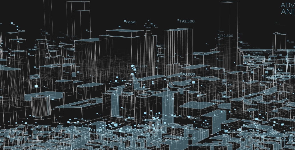
Leveraging GIS for Sustainable African Cities
With a population pegged at over 1 billion, African cities will house over 2 billion people by 2050, according to recent UN forecasts. The bulk of this growth will occur as people move from rural areas to contemporary urban centres.
Like the rest of the world, the rapid growth in population has caught many African cities unprepared. Key sectors like transportation, energy, sanitation, housing and food systems struggle to sustain the ever-increasing populations.
This makes the need to support sustainable African urbanisation urgent, and it should be a priority for all stakeholders within these cities. Leveraging GIS technology in African cities can help monitor infrastructure and urban planning programs.
The capacity to better identify existing demands for a city and then design it to meet those needs is one of the reasons GIS is significant in urban development. Urban planners, Architects Engineers and Construction managers (AEC) industry and policy makers are able to obtain a thorough understanding of the land and infrastructure. They can do this by by using some of the geo-enabled applications in ArcGIS that allow them to have 3D visualization of the ecosystems they’re building in.
The significance of GIS rests in its capacity to compile the enormous volumes of data required to balance conflicting agendas and resolve challenging issues, such as optimizing the location of new buildings or determining the viability of a waste disposal site.
ArcGIS Solutions (GeoPlanner, ArcGIS GeoBIM and ArcGIS Urban)
ArcGIS is able to provide solutions that will help build resilient communities and cities. These solutions allow you to:
- Identify areas that are vulnerable and can easily be impacted by climate change within our cities
- Use maps, models and 3D visualizations to measure design impact
- Measure, monitor and report on progress of the different development being taken in our cities
- Collaborate amongst teas, stakeholders and also gather perspective of the public during the different development phases of the city
- Create proactive response plans for dealing with hazards and natural calamities
Urban planners, AEC professionals and policy makers are empowered by GIS technology’s greater data visibility. They track changes over time, assess the viability of new initiatives, and foresee how they may affect the environment.
At Esri Eastern Africa we provide you with working ArcGIS. Visit our online store to purchase these products.
By Latimar Amukohe and Rachael Mutuli