KenGen’s GIS Portal Fueling a Digital Transformation
October 30, 2023 2023-10-30 11:22
KenGen’s GIS Portal Fueling a Digital Transformation
Kenya Electricity Generating Company (KenGen), a global leader in sustainable energy production, has undergone a remarkable digital transformation through the implementation of a Geographic Information System (GIS) portal and spatial data store. This transformation was vital as KenGen faced the challenges of rapid expansion in its production facilities and the dynamic landscape of renewable energy.
Related: GIS Transforms Uganda’s UEDCL, Expanding its Mission
Challenge
Traditionally, data management was cumbersome, leading to inefficiencies and duplicated information. Additionally, providing a comprehensive view of plant performance to decision-makers was time-consuming and error-prone. In response to these challenges, KenGen’s geomatics team devised the Integrated Resource Management Information System (IRMIS), a GIS-based solution.
Solution
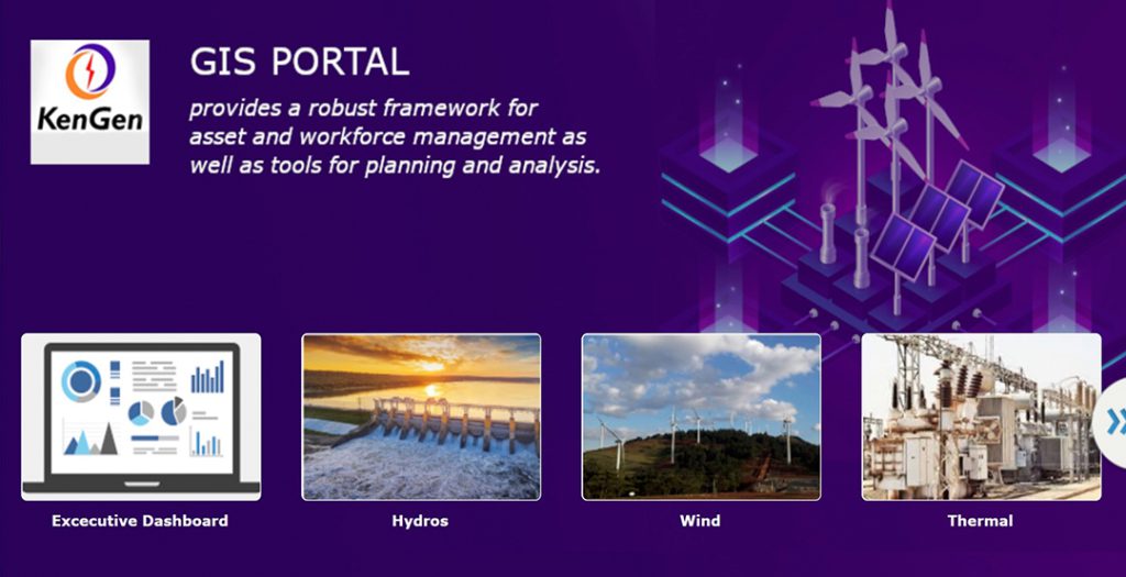
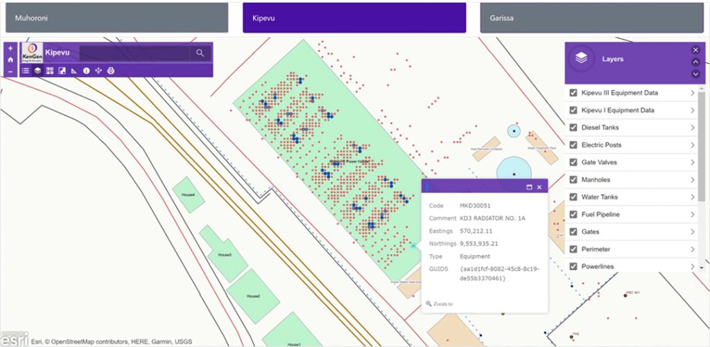
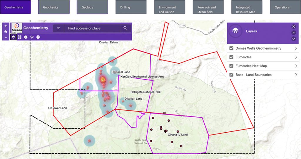
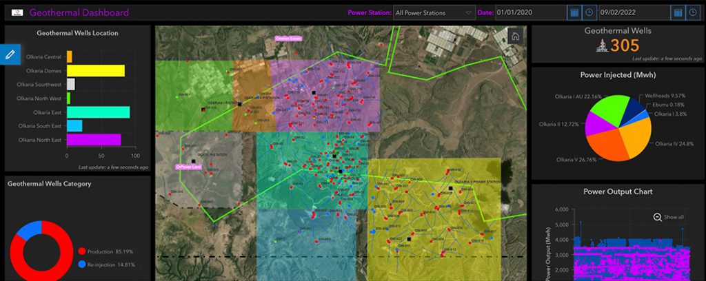
IRMIS empowers KenGen decision-makers by offering real-time insights into their assets, including geothermal wells, buildings, power plants, and hydro dams. It also aids in power distribution management, preventing supply disruptions. This transformation is underpinned by ArcGIS Enterprise, enabling efficient asset tracking and management.
IRMIS comprises seven major sections, including an Executive Dashboard and various portals dedicated to specific asset categories. Users can effortlessly query assets, perform analytics, and generate reports, enhancing operational efficiency. KenGen also integrated this data with its SAP plant management system.
The geomatics team followed a structured process for the implementation, aligning digital goals with the organization’s needs, selecting appropriate technology enablers, and fostering a digital culture among staff.
Related: Powering Data Online
Partner
Collaborating with Esri Eastern Africa, KenGen successfully consolidated spatial data, eliminating duplicate and inconsistent information. This transformation has led to cost savings, greater expertise, and streamlined operations. Users can create custom maps, reducing the burden on geomatics staff.
Results
IRMIS facilitates data access for various purposes, from engineering and design to project management, ultimately improving decision-making, reducing errors, and enhancing safety.
To meet the growing demand for this innovative system, KenGen plans to migrate to the cloud for improved scalability and performance. It also intends to expand self-service capabilities, enabling users to create custom maps and analytics. KenGen is actively sharing its success with other power suppliers in the region, thereby enhancing overall power plant efficiency.
In the future, KenGen aims to incorporate drone-captured imagery, 3D asset representations, and the system as a critical component for its digital twin, reinforcing its commitment to innovation and sustainability.
This story was first published by esri.com. Read full story here