GIS Transforms Uganda’s UEDCL, Expanding its Mission
October 30, 2023 2023-10-30 9:16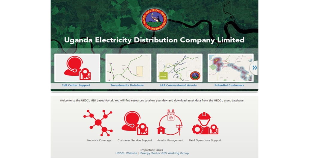
GIS Transforms Uganda’s UEDCL, Expanding its Mission
In 2001, Uganda Electricity Distribution Company Limited (UEDCL) emerged as a pivotal player in Uganda’s electricity sector, responsible for managing all distribution assets and overseeing private operator contracts. UEDCL’s mission was clear: to enhance operations for existing electricity consumers and extend access to those still without power.
Related: KenGen’s GIS Portal Fueling a Digital Transformation

Challenge
Challenges faced by the Ugandan electricity sector were many: aging assets, illegal connections, and equipment vandalism resulting in reduced efficiency and financial losses. A substantial portion of the population struggled to pay their electricity bills, with only half the population having access to electricity.
Historically, UEDCL relied on hard-copy records and later spreadsheets to inventory and assess asset conditions, but these methods were found to be inaccurate and lacked locational context. UEDCL lacked essential insights into potential customer locations, future demand, and faced difficulties integrating real-time systems like SCADA due to its dual role as an asset owner and operator.
Solution
UEDCL recognized the need for a change. In 2016, a GIS team was formed, selecting ArcGIS Enterprise as their GIS software. They initiated the creation of an asset registry and mapped their network, subsequently migrating data from spreadsheets. They then expanded their data collection capabilities using ArcGIS Field Maps.
Results
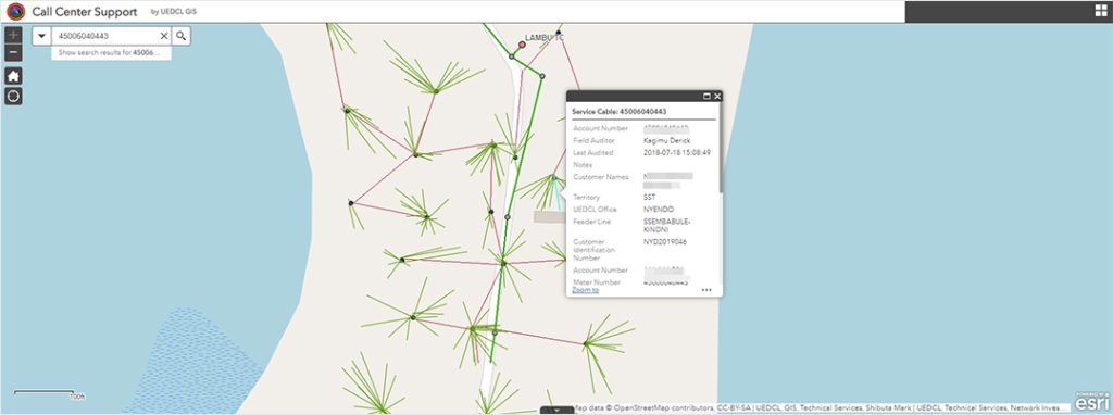
The pivotal moment came in 2018 when UEDCL deployed a GIS system based on ArcGIS Enterprise, which included a GIS portal and web apps. Dashboards created with ArcGIS Dashboards improved visibility, operational efficiency, and advanced UEDCL’s mission to connect more customers.
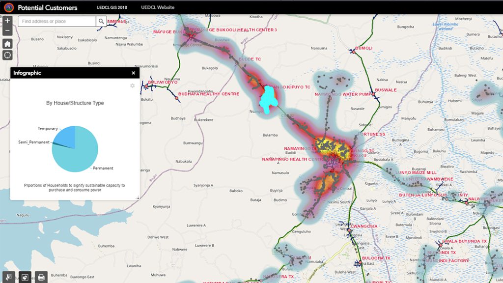
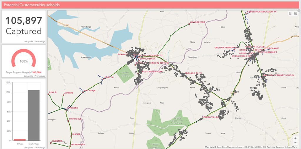
UEDCL’s GIS team harnessed ArcGIS’s spatial analysis capabilities to identify potential customers near the distribution grid, creating a list of low-hanging fruit opportunities and a highly accurate future load forecast. They distinguished between various types of buildings using imagery, facilitating future planning.
Partner
UEDCL collaborated with Esri Eastern Africa, and together they developed the system, provided consultation, configurations, training. In addition, UEDCL—in collaboration with the electric utility stakeholders in Uganda—is a member of Energy Sector GIS Working Group Uganda, which is committed to addressing the issues the sector faces, heavily leveraging the capabilities of GIS.
Benefits
The benefits were significant: efficient records management, unified information access, and data analytics capabilities, enabling better planning for network expansion, theft prevention, and improved customer interactions in the call center.
UEDCL’s future steps include integrating operational systems for optimized workflows and enhanced data capture during field operations. Their long-term goal is to provide affordable electricity to Uganda’s entire population, a mission made achievable through GIS.
This story was first published by esri.com. Read full story here