An Easy Solution to Your Data Management Problems
July 25, 2022 2022-07-25 6:18An Easy Solution to Your Data Management Problems
An Easy Solution to Your Data Management Problems
Data management and compilation are fundamental components of any GIS platform. Every day, we produce an increasing volume of data every time we perform a search, finish an online transaction, visit a website, or leave a comment on a blog post. This information has the potential to be a tremendous asset, but only if we can access it and extract the portions that are pertinent to our needs.
Today, almost all C-suite executives view data management as an essential tool for business strategy. Business leaders may use the data they gather from suppliers and customers to drive growth by managing data effectively. Therefore, GIS and data management are critical for the success of any project by providing effective storage, management, and distribution of valuable data.
Through data management, you’ll be able to extract information and insights from raw data, display it on a map with the help of GIS technology and fulfill your information needs. The expansion of computerized data-collection techniques in recent years has made obtaining, organizing, storing, sharing, and displaying data easy for all geospatial data users.
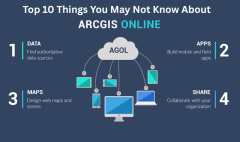
Esri Eastern Africa provides you and your organization with ArcGIS software – a full-featured, integrated GIS platform. This system enables information management, map and data organization and visualization, and analysis of links and patterns across any area.
With this software, you’re able to create, organize, and carry out predictive analytics and use these analytics to influence your decisions. This makes the platform a system of insight as well as a tool to manage your data. The ArcGIS system also enables data management through engagement as well, integrating people, groups, departments, and entire companies with common knowledge by utilizing web services. This encourages communication and cooperation among remote systems and individuals.
For example, ArcGIS Pro can manage geographic data using geodatabase. Datasets are created and stored in the geodatabase using both spatial and non-spatial data. Different dataset types stored in geodatabase include tables, feature classes, relationship classes, topologies, and utility network enabling you to focus on one particular dataset at a time.
Data comes in a wide range of formats and data structures, as well as in varying degrees of quality, which can lead to a confusing collection of useful and pointless bits of explicit data that must be pushed, prodded, and wrangled into a single, unified dataset. GIS examines the fundamental challenges associated to data gathering and management and offers a solution.
Click here to purchase our ArcGIS products online.


