Promoting Sustainable Agriculture
October 5, 2022 2022-10-05 9:22
Promoting Sustainable Agriculture
Globally, agricultural practices have evolved over time, and the use of GIS has enabled farmers to better understand their fields and environments especially in relation to precision agriculture and acquisition of data on other objects in space. GIS offers an incredible array of benefits to agriculture because it uses modern technology to produce accurate maps, a better understanding of the environment, and better management decisions regarding water conservation and infrastructure. With GIS we can see where conflicts are developing between landowners (who are increasingly looking for a solution), local farmers (who need reliable information about their resources) and the government (who needs to manage its vast land holdings in the most efficient way possible).
This technology is useful in collecting huge amounts of data from satellite images, by quantifying landscape changes and taking advantage of the “tomorrow’s sun” perspective, which offers a real-time look into the changing environment. The technology has also helped in agricultural forecasting and drought prediction, modelling urban growth and other smaller tasks with which it can be used for making better agricultural decisions.
This article outlines how GIS is promoting sustainable agriculture.
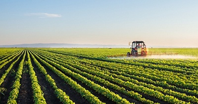
Precision agriculture
Precision Agriculture (PA) stands for concentration of small inputs on the specific location to achieve high-level crop productivity. This is done by managing several fields to get best results. GIS has helped PA by analyzing and presenting data in an organized way. GIS, with the help of (GPS, or Global Positioning System), has allowed field service crews to track growth and produce yields in real time. This allows farmers to design more precise fields, able to meet growing consumer demand.
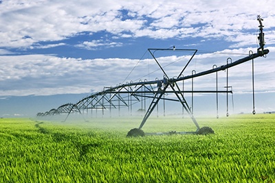
Smart irrigation
GIS helps smart irrigation in agriculture by helping one to know the exact time, location and amount of water required for irrigation. It also helps to create a detailed GIS map that can be used for planning purposes. This technology provides information about soil types, surface water and groundwater reservoirs, land use, and topography. It also allows presentation of useful information for farmers such as crop yields of different crops, storage capacity of groundwater reservoirs, maximum stream flow velocity and its relation to area irrigated.
Plant health
In agriculture, plant health is the state of a plant or crop. GIS has helped in providing various applications pertaining to agriculture. GIS technology, which works remotely from a central location, helps plant health professionals identify disease conditions and monitor the movement of diseases and pests into different countries. Furthermore, it allows you to know where diseased crops are and how much time it will take for them to recover.
Food security
GIS has been a key technology for supporting food security in agriculture. The use of GIS gives farmers access to information which helps them plan their farms better, leads to more efficient usage of resources and ensure that they get maximum yield from their crops. It helps identify the distribution of crops and their pests, conditions for yields, locations for food production and potential productivity enhancement. By using this technology, farmers can find out where to deploy technologies such as irrigation or fertilizer as well as know where to detect diseases. This helps reduce crop loss during times of failure and increase yields instead.
GIS is a fast-growing, exciting, and inexhaustible field. With access to the best maps, GIS can help improve productivity by using technology to manage mappings, remotely identify farm boundary overlaps and overlaps with conservation areas, detect points of interest on farms and help optimize efficiency of farming activities.
Are you a farmer looking for better ways to optimize efficiency in your farming activities? Esri Eastern Africa has a solution for you.
Visit Esri EA’s online store to make a purchase of ArcGIS products