Know your options when it comes to GIS data formats
December 13, 2022 2022-12-28 7:11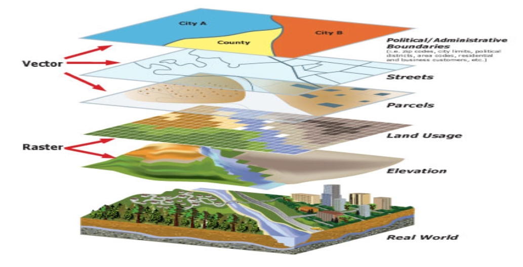
Know your options when it comes to GIS data formats
Since you’re reading this, it’s safe to assume that you’re interested in implementing geographical information systems (GIS) within your organization. If you’re like most people, that means you have a large amount of data and want to know how to organize it within your software and use it effectively. There are several ways you can do this; some formats are better suited than others for specific tasks. This article will get you started by teaching you about several commonly used GIS file formats for vector data and raster data formats to help you choose the correct GIS data set format.
File formats include:
Vector GIS file formats
Vector data is not made up of pixel grids. Instead, vertices and pathways make up vector graphics. Points, lines, and polygons are the three fundamental forms of symbols for vector data.
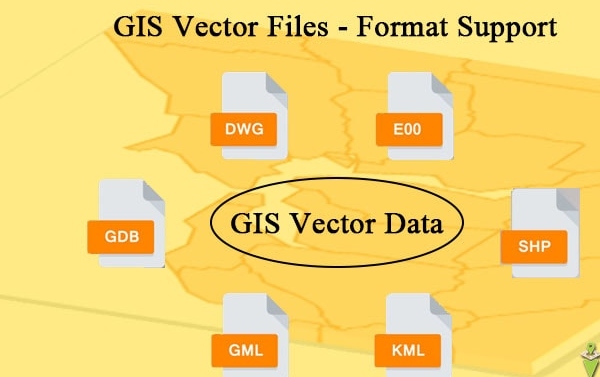
Vector GIS file formats include:
- Shapefiles: These are the most widely used GIS file format. They allow you to store point, line, and polygon data on one sheet of paper. You can view them in various mapping tools, but these tools require special software to view them.
- Geographic JavaScript Object Notation (GeoJSON): The GeoJSON format is primarily for web-based mapping. GeoJSON stores coordinates as text in JavaScript Object Notation (JSON) form.
- Geography Markup Language (GML): GML allows for using geographic coordinates extension of XML. And eXtensible Markup Language (XML) is both human-readable and machine-readable.
- Google Keyhole Markup Language (KML/KMZ): KML stands for Keyhole Markup Language. This GIS format is XML-based and is primarily used for Google Earth.
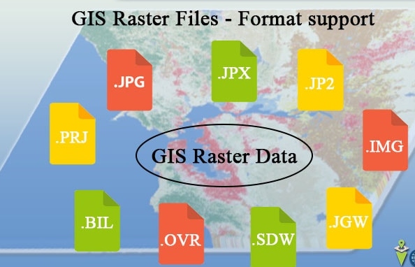
Raster GIS file formats
Each pixel in raster data is a raster (also called grid cell). Raster formats can be square or regularly spaced. Rasters have pixels with a value (continuous) or class attached to them (discrete). Examples of these file formats may include:
- ASCII Data Files: ASCII uses numbers (including floats) between 0 and 255 for information storage and processing. They also contain header information with a set of keywords.
- PCI Geomatics Database File (PCIDSK): PIX files are raster storage layers developed by PCI Geomatics. It’s a flexible file type that stores all images and auxiliary data called “segments” in a self-contained file. For example, segments can include image channels, training sites, and histogram information.
- Esri Grid: Grid files are a proprietary format developed by Esri. Grids have no extension and are unique because they can hold attribute data in a raster file. But the catch is that you can only add attributes to integer grids.
Before downloading GIS data, it’s essential to understand the type of data format the specific dataset is available in. Some formats are more common than others and offer features that allow easier data manipulation once you download them.
Esri Eastern Africa offers training programs to help you choose the suitable GIS data format. Click here to explore our training options.