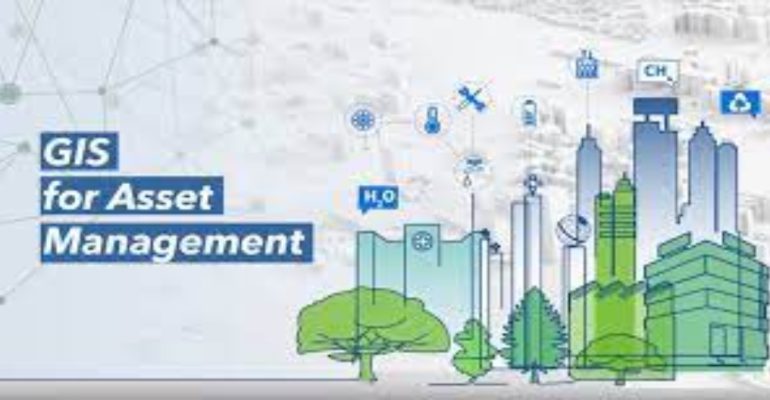
Harnessing the Power of ArcGIS for Efficient Asset Management
September 11, 2023 2023-09-11 11:44Harnessing the Power of ArcGIS for Efficient Asset Management
Effective asset management is crucial for businesses and organizations of all sizes in the first-paced world of today. Whether you’re managing infrastructure, utilities, or facilities, the capacity to monitor, maintain, and optimize assets can have a substantial impact on operational effectiveness and cost-effectiveness. ArcGIS provides a potent toolkit for effective asset management that goes above and beyond conventional approaches. This article explores how utilizing ArcGIS’s capability can transform asset management procedures and produce real results.
Related: Addressing Supply Chain Issues with GIS: Solving Logistics Challenges
Understanding asset management
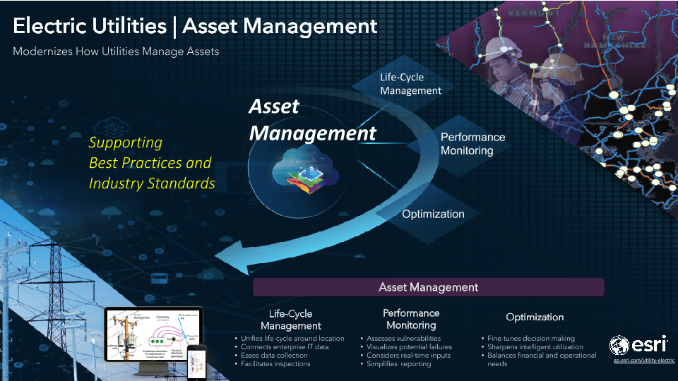
Asset management involves tracking, analyzing, and maintaining physical assets to ensure optimal performance throughout their lifecycle. This includes everything from equipment and machinery to facilities, pipelines, and utilities. Efficient asset management minimizes downtime, extends asset lifespan, reduces costs, and enhances overall productivity.
The ArcGIS advantage
ArcGIS provides a geospatial foundation for asset management the integrates location-based information with attributes and real-time data. This spatial context enriches asset information, enabling better decision-making and streamlined workflows.
Here is how ArcGIS enables efficient asset management:
Data centralization and visualization
ArcGIS allows users to create comprehensive asset inventories by storing asset information in a centralized database. Geospatial data visualizations provide a clear overview of asset locations, conditions, and relationships. Maps and dashboards help stakeholders understand asset distribution and status at a glance.
Data analysis and insights
ArcGIS offers advanced spatial analysis tools that go beyond tabular data. Users can perform proximity analysis, identify asset clusters, and assess environmental impacts. By overlaying assets with geographic data such as land use and demographics, organizations gain insights that inform planning and resource allocation.
Real-time monitoring and predictive maintenance
ArcGIS integrates with Internet of Things (IoT) devices, enabling real-time asset monitoring. Sensors placed on assets can transmit data on performance, temperature, and other critical parameters. This data can be analyzed using ArcGIS tools to predict maintenance needs, preventing costly breakdowns.

Reporting and compliance
ArcGIS streamlines reporting for regulatory compliance. Organizations can generate custom reports and visualize data trends, making it easier to demonstrate compliance with environmental standards, safety regulations, and other requirements.
Mobile data collection
ArcGIS enables field workers to collect data directly in the field using mobile devices. They can update asset information, track maintenance activities, and submit reports in real time. This minimizes paperwork, reduces errors, and ensures accurate and up-to-date records.
Related: ArcGIS Field Apps

Risk assessment and decision support
By analyzing asset data in the context of geographical factors such as terrain and proximity to hazards, ArcGIS facilitates risk assessment. This helps organizations make informed decisions about asset placement, emergency response planning, and disaster recovery.
Collaboration and stakeholder engagement
ArcGIS Online allows for easy data sharing and collaboration among stakeholders. Whether it’s internal teams, regulatory agencies, or the public, sharing geospatial data fosters transparency, improves communication, and aligns efforts.
Are you ready to revolutionize the way you manage your assets? Visit our online store to explore a wide range of ArcGIS products tailored for your needs.


