Exploring ArcGIS ModelBuilder for GIS Professionals
June 2, 2023 2023-06-02 14:03Exploring ArcGIS ModelBuilder for GIS Professionals
Spatial modeling plays a crucial role in Geographic Information Systems (GIS) by enabling professionals to automate complex geoprocessing tasks, streamline workflows, and extract meaningful insights from spatial data. With ArcGIS ModelBuilder, a visual programming tool, GIS professionals can create and execute spatial models without writing complex code. In this article, we delve into the power of ArcGIS ModelBuilder and how it simplifies spatial modeling, making it accessible to GIS professionals of all skill levels.
How ArcGIS ModelBuilder simplifies spatial modeling
Here is how ArcGIS ModelBuilder simplifies spatial modeling:
Visual interface for intuitive model creation
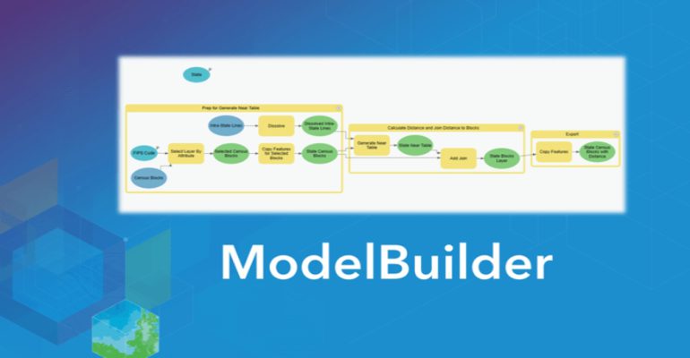
ArcGIS ModelBuilder provides a user-friendly, drag-and-drop interface that allows GIS professionals to build spatial models through a visual representation of their workflows. Instead of writing code, users can select tools from an extensive library and connect them together to define the data processing steps. This visual interface makes it easy to conceptualize, design, and modify models, even for those with limited programming experience. By eliminating the need for manual coding, ArcGIS ModelBuilder empowers GIS professionals to focus on the logic and structure of their models.
Streamlined workflow automation
GIS professionals often need to perform repetitive and time-consuming geoprocessing tasks. ArcGIS ModelBuilder excels at streamlining these workflows by automating complex processes. By stringing together, a series of tools and operations, users can create models that automate data conversion, spatial analysis, data integration, and more. This automation not only saves time and effort but also minimizes errors that may occur during manual execution. With ArcGIS ModelBuilder, GIS professionals can execute complex workflows with a single click, allowing them to focus on higher-level analysis and decision-making.
Integration and reproducibility
ArcGIS ModelBuilder integrates seamlessly with other components of the ArcGIS platform, enabling GIS professionals to leverage the power of different tools and extensions within their models. Whether it’s incorporating Python scripts, custom geoprocessing tools, or extensions like Spatial Analyst or 3D Analyst, ModelBuilder provides a unified environment for integration and customization. Additionally, the models created in ArcGIS ModelBuilder are highly reproducible. Users can save and share their models, allowing others to reproduce the same analysis, ensuring consistency, and facilitating collaboration among GIS professionals.
Iterative model development and documentation
ArcGIS ModelBuilder supports iterative model development, enabling GIS professionals to refine and enhance their models over time. As requirements change or new data becomes available, users can easily modify existing models without starting from scratch. This iterative approach facilitates model optimization and allows professionals to fine-tune their workflows for improved efficiency and accuracy. Additionally, ArcGIS ModelBuilder automatically generates model documentation, providing a clear record of the model’s purpose, inputs, outputs, and steps. This documentation aids in understanding, sharing, and maintaining the models, ensuring their longevity and usefulness.
Whether you’re a seasoned GIS expert or a beginner, ArcGIS ModelBuilder opens a world of possibilities for spatial modeling, making it accessible and efficient for GIS professionals of all skill levels.
You can now buy it online!


