ArcGIS Maritime Extension – making marine data accessible!
November 21, 2022 2022-11-28 9:55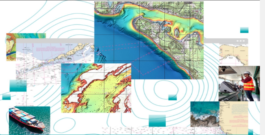
ArcGIS Maritime Extension – making marine data accessible!
ArcGIS Maritime is a complete system for managing and producing maritime data and products compliant with the International Hydrographic Organization’s (IHO) S-57 and S-4 standards, as well as MIL-PRF-89023 performance specification for Digital Nautical Charts (DNC). It provides tools that allow to ingest S-57 data into the Esri platform.
ArcGIS for maritime consists of two module which include: Bathymetry and Charting
| ArcGIS for maritime: Bathymetry: | ArcGIS for maritime: Charting |
| Deals with underground water study i.e., depths | Focus on navigable water surface. |
| Store, discover, model and manage bathymetric data. | Create, maintain and publish charts for navigational and marine purposes. |
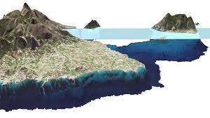
ArcGIS for Maritime: Bathymetry.
Bathymetry is the study of under water depth of ocean floors or lake floors. It is equivalent to hypsometry and topography. Some of the data collection methods include using SONAR (Sound navigation ranging) devices, LIDAR (Light Detection and Ranging) Technologies.
ArcGIS Bathymetry GIS enables bathymetric data management by providing an easy-to-use, scalable solution that leverages the power of ArcGIS. Its ability to support a broad range of data types, combined with the visualization and analysis tools in ArcGIS, increases the value of your bathymetry data. Bathymetry offers intuitive user interfaces and geoprocessing tools that are suitable for novice and advanced GIS users. Customized metadata streamlines data access and enables quick generation of custom bathymetric surfaces through targeted data selection and prioritization. Information can be extracted quickly, eliminating unnecessary duplication.
Uses of bathymetric data
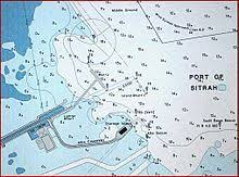
- Nautical Charts: These charts are used to guide mariners so having accurate information about the depth of water and potential underwater hazards is essential for safe maritime transportation, especially for large ships.
- Studying coastline changes: Scientist use this data to study effects climate change and to monitor beach erosion, sea level rise and land sinking.
- Hydrodynamic models: It is used to create models that can calculate currents, tides, water temperature, and salinity in an area. These models can also be used to predict tides and currents, as well as hazards like coastal flooding and rip tides.
- Studying marine life: It is used to study the habitats of benthic (bottom-dwelling) organisms. Bathymetric maps can help scientists determine where fish and other marine life feed, live, and breed. Bathymetric data is also used to create maps of coral habitats to assist in conservation and monitoring.
ArcGIS for Maritime Charting.
ArcGIS for Maritime: Charting is a complete system for managing maritime data and products can be used in the production of IENC, ENC etc. It can be used for the creation and maintenance of traditional standards-based nautical products, such as electronic and paper charts, as well as to generate innovative products that enable groups of people inside and outside your organization to mine the rich content available in maritime data. Data is stored in Nautical Information system. ArcGIS Maritime is a system of recording where you store and manage bathymetric and nautical assets while ArcGIS maritime server is a system of engagement where you share products and services to many users.
Industries that make use of this data include:
- Hydrological departments- during the production of nautical charts or navigational charts.
- Oil & Gas-During mining
- Defense-Submarine deployment.
- Other industries include coastal engineering, ports, Survey company, marine sciences, habitat mapping, coast, and marine spatial planning etc.
You can purchase ArcGIS Maritime Extension online. Click here to make your purchase.