Five Powerful Capabilities of ArcGIS 3D Analyst
June 2, 2023 2023-06-02 11:21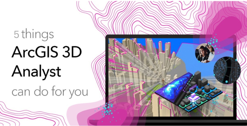
Five Powerful Capabilities of ArcGIS 3D Analyst
ArcGIS 3D Analyst is a comprehensive extension of the popular ArcGIS platform that enables users to visualize, analyze, and model spatial data in a three-dimensional environment. With its robust set of tools and functionalities, ArcGIS 3D Analyst empowers professionals across various industries to extract valuable insights from their data. In this article, we will explore five key capabilities of ArcGIS 3D Analyst that can revolutionize the way you work with spatial data.
Related: 3 Things ArcGIS Pro Can Do for You
Capabilities of ArcGIS 3D Analyst
Here are the five powerful capabilities of ArcGIS 3D Analyst:
Create and analyze 3D terrain
ArcGIS 3D Analyst provides a suite of tools to create and analyze 3D terrain, enabling users to understand the topography of a given area. You can generate elevation models from various sources, such as LiDAR data or contour lines, and create visually stunning representations of landscapes. This capability is particularly useful for applications like urban planning, flood modeling, and terrain analysis for infrastructure development.
Visualize and navigate in 3D
With ArcGIS 3D Analyst, you can seamlessly explore and navigate your spatial data in a three-dimensional environment. Whether you are examining a cityscape, inspecting a construction site, or visualizing underground utilities, the software enables you to interactively view and analyze data from any angle or perspective. This capability enhances spatial understanding and aids in effective decision-making.
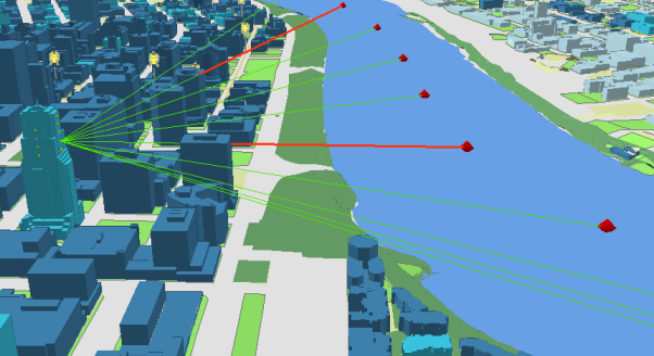
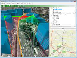
Perform 3D spatial analysis
ArcGIS 3D Analyst offers a rich suite of spatial analysis tools designed specifically for three-dimensional data. You can conduct advanced analyses such as viewshed analysis, line-of-sight analysis, volumetric analysis, and surface interpolation. These analyses help in assessing visibility, identifying optimal locations, estimating volumes, and modeling various scenarios. The ability to perform these analyses in a 3D environment enhances accuracy and provides deeper insights into complex spatial relationships.
Conduct 3D network analysis
ArcGIS 3D Analyst allows users to perform network analysis in three dimensions. You can model and analyze transportation networks, utility networks, and other network systems in a 3D space. By considering the elevation and vertical connectivity, you can better understand how features interact with each other in a network, optimize routing decisions, and identify potential issues such as clearance constraints or obstructed views.
Create dynamic 3D visualizations
ArcGIS 3D Analyst enables you to create dynamic and interactive 3D visualizations that effectively communicate complex spatial information. You can produce flythroughs, animated tours, and interactive scenes to present your data in a compelling manner. These visualizations are invaluable for sharing insights with stakeholders, showcasing project proposals, or enhancing public engagement.
Whether you’re an urban planner, environmental scientist, infrastructure engineer, or GIS professional, ArcGIS 3D Analyst can revolutionize the way you work with spatial data, unlocking new possibilities for understanding and visualizing the world around us.
Click here to buy ArcGIS Products online.