What’s New in ArcGIS Urban – July 2025
July 25, 2025 2025-07-25 11:56What’s New in ArcGIS Urban – July 2025
Urban planners work at multiple scales, from detailed site designs to city-wide visions. The July 2025 ArcGIS Urban update brings new tools to support planning workflows at every level.
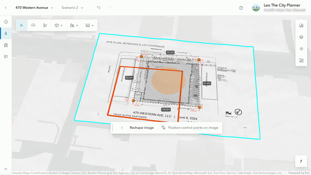
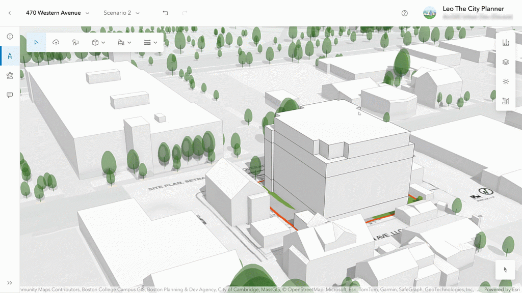
Bring Site Plans into Spatial Context
If you primarily use ArcGIS Urban for managing site plans, there’s now an easier way to incorporate your 2D blueprints. You can upload images of your site plans directly into project scenarios and accurately align them on the map. This allows you to visualize proposals in their real-world context, without needing 3D models upfront.
Once uploaded, you can sketch out simple 3D massings based on the blueprint to assess scale, placement, and fit. Even better, replacing a site plan with an updated version won’t require repositioning, Urban keeps everything aligned automatically.
Set the Default Scenario View
To help stakeholders stay focused on what’s important, Urban now lets you choose which project scenario should appear by default in both the overview and the plan editor. This ensures active proposals are front and center, making it easier for collaborators and decision-makers to see the most relevant version.
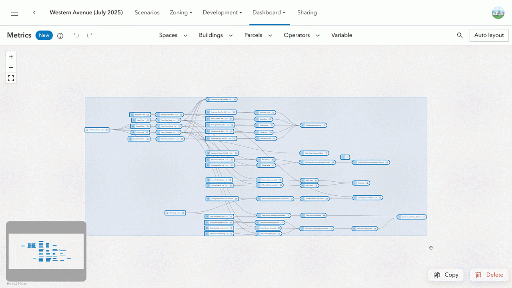
Copy and Reuse Metrics Easily
Urban’s metrics tools offer powerful ways to analyze the impact of development. But reusing those metrics across different plans or models was previously limited. That changes with this release.
You can now copy metrics from one plan and paste them into another, or even across entire urban models. A dialog box helps you map the appropriate space-use types so that calculations remain accurate in the new context. This saves time and promotes consistency across your projects.
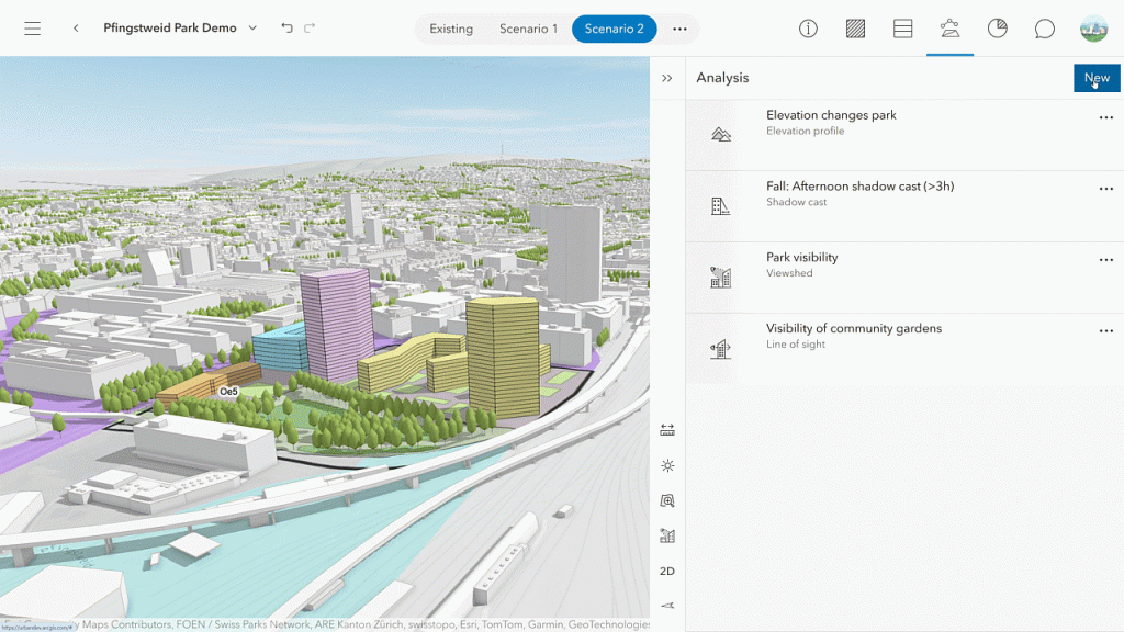
Explore Deeper with Analysis Mode
Understanding a proposal’s impact isn’t only about numbers. Spatial context matters: Will a proposed building cast shadows on a park? Will it block scenic views?
The new Analysis Mode in the plan editor brings all key tools; shadow cast, elevation profile, line of sight, and viewshed into one place. You can now save, manage, and revisit your analyses using a persistent list, making collaboration and refinement easier than ever.
Enhanced Collaboration with Channels
Effective urban planning relies on input from diverse stakeholders. To support better collaboration, ArcGIS Urban now includes a redesigned Discussions feature, centered around a new concept called Channels. Channels help organize conversations and control access, ensuring the right people are engaged at the right stage of planning.
Updates to the Urban API
Developers will appreciate that the Urban API now supports setting the default project scenario programmatically. Additionally, a new input option in the shadow cast analysis lets you define the time interval for individual shadow slices, offering more flexibility in your visual assessments.
Disclaimer: This article is an adapted version of the original post written by Dominik Allemann and Katie Thompson, published on Esri.com. Read the full article here.