Enhanced 3D Layers in ArcGIS: Taking Visualization to the Next Level
May 16, 2025 2025-07-17 7:11Enhanced 3D Layers in ArcGIS: Taking Visualization to the Next Level
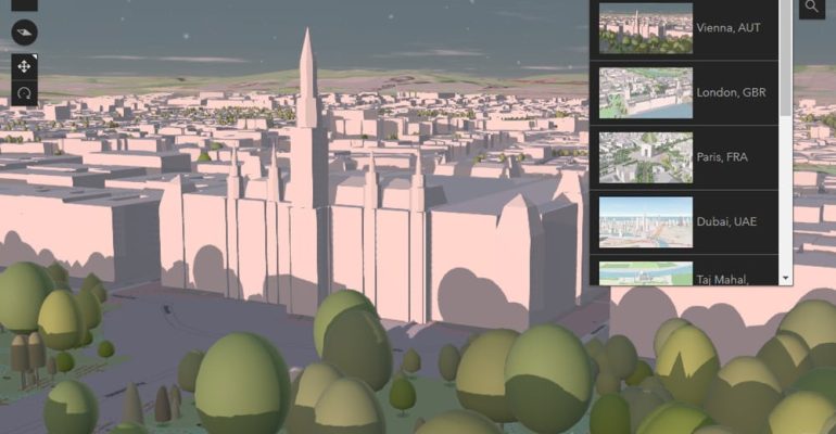
Three years ago, Esri introduced OpenStreetMap (OSM) 3D scene layers, revolutionizing how users could visualize spatial data in three dimensions. Two years later, Esri launched new 3D Basemaps that utilized these OSM scene layers, integrating them into the basemap gallery for 3D ArcGIS applications such as Scene Viewer and ArcGIS Pro.
These basemaps are built on the open data from the OSM Daylight Distribution, enriched with contributions from the OSM community and enhancements by the team maintaining the distribution. The result is a robust and dynamic toolset for geospatial visualization.
Related: Five Powerful Capabilities of ArcGIS 3D Analyst
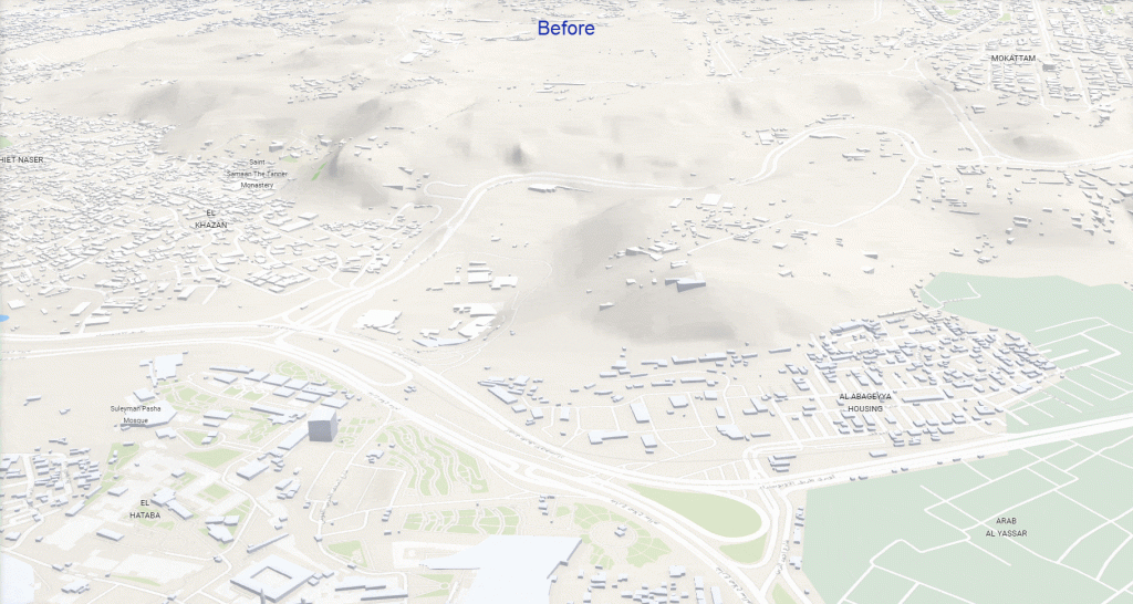
Elevating Terrain Accuracy with Maxar Precision3D
The terrain surface is a fundamental component of a 3D basemap, and Esri’s Terrain 3D elevation layer leverages high-quality data from open, commercial, and community sources. Recently, Esri enhanced this layer by integrating Maxar Precision3D data, featuring 50 cm resolution Digital Terrain Models (DTM) derived from high-resolution satellite imagery. These improvements significantly enhance the visual and spatial accuracy of 3D Basemaps, especially in hilly terrains like Uptown Cairo, Egypt.
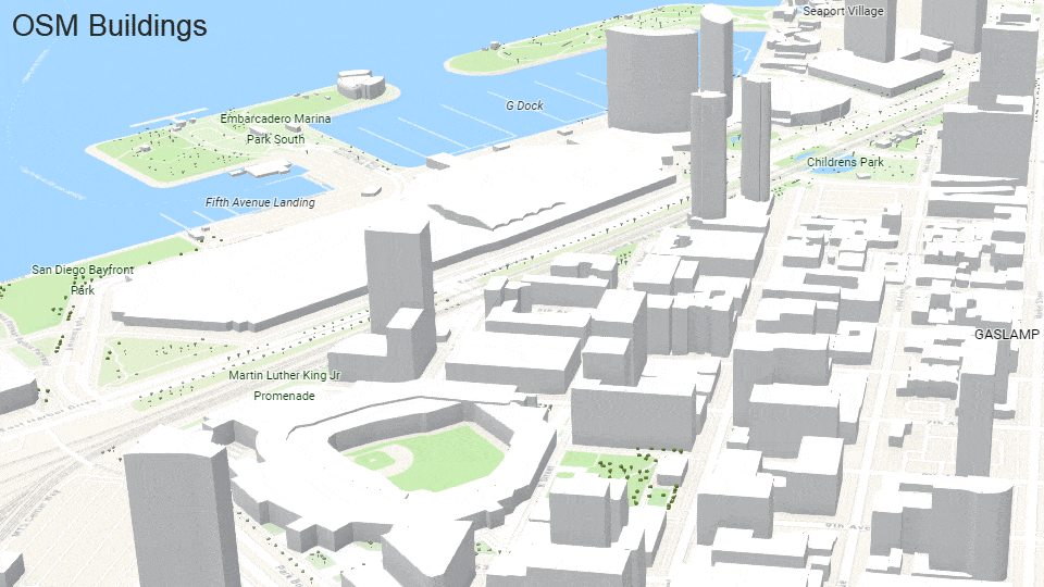
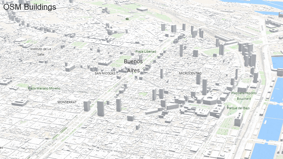
Enhancing Building Data for Realistic Visualization
While the OSM Daylight Distribution offers over 1.4 billion buildings worldwide, many lack 3D attributes such as height or levels. To address this, Esri has incorporated commercial data from partners like Maxar and TomTom, as well as community contributions, to develop the Esri 3D Buildings scene layer. This layer now includes hundreds of millions of multi-part buildings with precise 3D attributes, significantly improving visualization and analysis, particularly outside North America and Europe.
Looking Ahead: Expanding the 3D Building Dataset
In the coming months, Esri plans to expand the Esri 3D Buildings scene layer with additional commercial, community, and open data, including contributions from the Overture Maps buildings theme. GIS community members can support this expansion by sharing their 3D building data via Esri Community Maps.
Join the Conversation
To learn more about these advancements, attend the Esri User Conference or visit the ArcGIS Living Atlas Area in the Esri Showcase to engage with experts and explore the latest in 3D mapping.
By Deane Kensok
Originally published on July 2, 2024, this article has been updated to include the latest developments in 3D scene layers and basemaps.