Empowering Field Teams with the ArcGIS Mobile Worker License
September 24, 2025 2025-09-24 14:02Empowering Field Teams with the ArcGIS Mobile Worker License

For organisations seeking to streamline data collection and field operations, the ArcGIS Mobile Worker license offers a practical solution. Designed specifically for mobile use, it enables field teams to gather, access, and interact with geospatial data whether they’re online or offline.

Comparing the Mobile Worker to other ArcGIS licenses
Within the broader ArcGIS licensing framework, the Mobile Worker sits as a mid-tier user type. While more limited than Creator or Professional licenses, it provides essential capabilities needed for fieldwork—like viewing, editing, and collecting data using ArcGIS mobile apps. These include ArcGIS QuickCapture, Survey123, Field Maps, and Navigator, all tailored to support efficient, accurate mobile workflows.
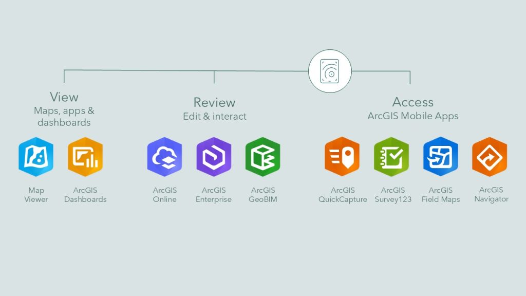
In June 2025, ArcGIS Navigator was integrated into the Mobile Worker license, enhancing functionality with advanced navigation and routing tools. This means mobile staff can now travel efficiently between job sites, follow optimized routes, and receive real-time updates—all within a unified system.
Benefits of the ArcGIS Mobile Worker License
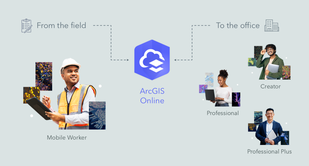
It’s important to note that the Mobile Worker license complements rather than replaces the more advanced user types. While Mobile Workers can interact with and update geospatial data, tools for deeper analysis, map creation, and system configuration remain the responsibility of Creator or Professional users. This structure ensures a smooth collaboration between office-based teams and those in the field.
So, what does this look like in action? Picture inspection crews accessing field maps, recording observations on a tablet, and syncing updates directly to a central cloud platform, no paperwork needed. Supervisors back in the office can monitor progress, assign new tasks, or review collected data in near real-time.
This kind of integrated workflow not only reduces errors and data duplication but also speeds up reporting and decision-making. From local councils inspecting infrastructure to environmental teams monitoring wildlife habitats, the Mobile Worker license supports a wide variety of use cases.
Ultimately, this user type bridges the gap between GIS professionals and mobile crews. It keeps fieldwork connected, data flowing, and teams aligned no matter where the job takes them.
Want to explore more?