
How GIS Helped Reveal Bwindi’s Hidden Chimpanzee Population
July 31, 2026 2026-07-31 7:32
How GIS Helped Reveal Bwindi’s Hidden Chimpanzee Population
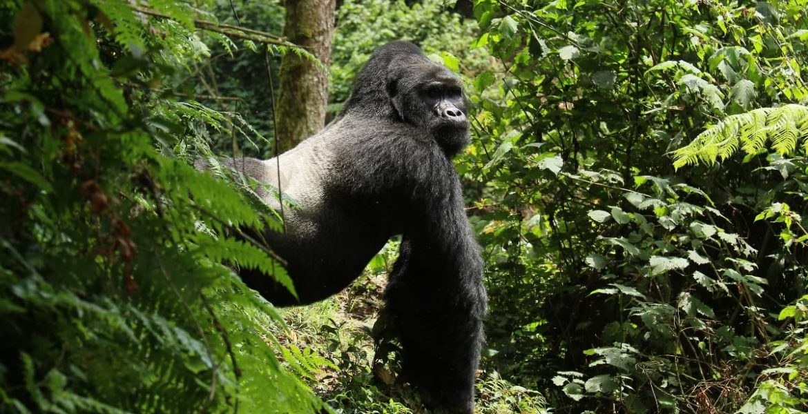
For years, conservationists monitored Uganda’s Bwindi Impenetrable National Park from above, using satellite imagery and remote sensing to understand one of Africa’s most biologically rich forests. Yet one critical question remained unanswered: How many chimpanzees actually live in Bwindi? The answer could only be found on the ground.
Combining advanced GIS technology with weeks of fieldwork through some of Africa’s most challenging terrain, the Jane Goodall Institute (JGI), in partnership with the Uganda Wildlife Authority (UWA), completed the first systematic chimpanzee census in Bwindi. Their efforts revealed a population of 426 chimpanzees living alongside the park’s famous mountain gorillas – an important discovery that is reshaping conservation strategies for one of the world’s most important ecosystems.
Mapping the Unknown
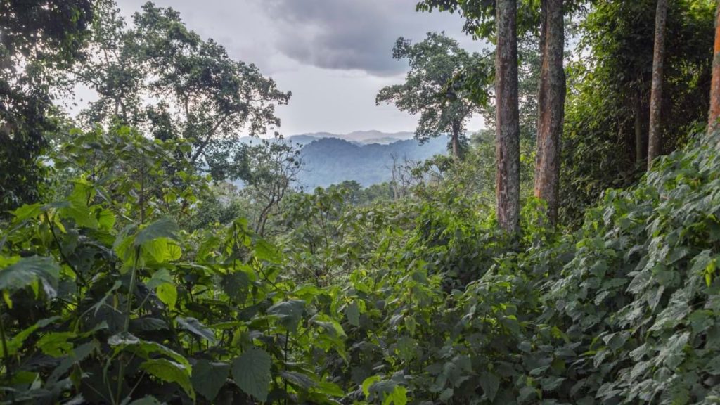
Although Bwindi is globally recognized for its endangered mountain gorillas, relatively little was known about its chimpanzee population. Dense vegetation, steep mountains, and limited visibility make direct observation almost impossible. To overcome these challenges, JGI combined satellite imagery, GIS, and mobile data collection with traditional wildlife survey techniques.
Before entering the forest, conservation scientists analysed high-resolution satellite imagery and terrain data using ArcGIS Pro. The technology enabled the team to map drainage networks, steep slopes, rivers, and forest access routes while designing 39 standardized survey transects covering the park’s 330 square kilometres. This careful planning ensured that field teams could systematically survey even the most difficult-to-reach parts of the forest.
GIS Supporting Every Step
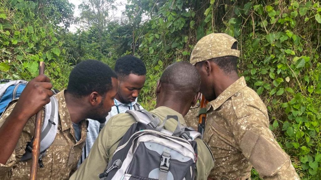
Once in the field, GIS continued to guide the census. Five survey teams, comprising Uganda Wildlife Authority rangers and trained conservation staff, spent six weeks traversing more than 160 kilometres of dense forest. Using ArcGIS Survey123, they recorded the GPS location of every chimpanzee nest, measured its distance from survey lines, captured photographs, and documented additional observations including gorilla nests, elephant signs, and evidence of illegal human activity.
Each evening, the collected data was reviewed, validated, and integrated into updated maps, allowing project leaders to monitor progress and quickly identify any inconsistencies before the next day’s survey. The digital workflow significantly improved data quality while enabling real-time decision-making throughout the census.
A Remarkable Discovery
The census confirmed the presence of 426 chimpanzees across Bwindi and uncovered surprising ecological findings. Researchers discovered fresh chimpanzee nests alongside mountain gorilla nests built on the same night—an unusual occurrence that highlights the unique relationship between the two great ape species within the park.
The survey also revealed important differences across the forest. While the southern sector benefits from well-established gorilla tourism and conservation efforts, the northern section showed higher levels of illegal activities such as snaring, firewood collection, and pole cutting. These insights are helping conservation organizations better target community engagement and habitat protection initiatives.
Conservation Begins with Communities
The project reinforced one of the Jane Goodall Institute’s core principles: successful conservation depends on local communities. Beyond collecting data, the census equipped rangers and community members with practical GIS skills. Many participants were trained and certified in ArcGIS Survey123, giving them new technical capabilities while strengthening local ownership of conservation efforts.
The resulting data provides a scientific baseline for future monitoring while helping governments, conservation organisations, and local communities make better-informed decisions about protecting Bwindi’s biodiversity.
Technology Driving Conservation
The Bwindi chimpanzee census demonstrates how modern GIS technology is transforming wildlife conservation. By integrating ArcGIS Pro, ArcGIS Survey123, remote sensing, satellite imagery, and spatial analysis, conservation teams were able to map one of Africa’s most inaccessible forests with unprecedented accuracy.
More importantly, the project shows that technology alone is not enough. When paired with local expertise, scientific collaboration, and community participation, GIS becomes a powerful tool for protecting biodiversity and supporting sustainable conservation. As environmental challenges continue to grow, initiatives like the Bwindi chimpanzee census illustrate how geospatial technology can bridge the gap between science and action, helping safeguard wildlife while empowering the people who live alongside it.
This feature is adapted from an original story published on Esri’s Newsroom. For the complete story and additional insights, read the full article here: https://www.esri.com/about/newsroom/blog/bwindi-impenetrable-forest-chimpanzee-count