What’s New in ArcGIS Drone2Map 2026.1
September 7, 2026 2026-09-07 12:14
What’s New in ArcGIS Drone2Map 2026.1
Drone imagery is becoming an increasingly valuable source of spatial information for organizations working across surveying, construction, infrastructure, agriculture, environmental management, disaster response, and other industries. With the release of ArcGIS Drone2Map 2026.1, drone mapping workflows are becoming faster, more flexible, and better equipped to handle increasingly complex datasets. The latest release introduces improvements to processing performance, image calibration, thermal imagery support, ground control workflows, cloud-optimized outputs, and 3D visualization.
For GIS professionals looking to get more value from their drone imagery, here are some of the key enhancements to explore.
Faster Processing and Greater Detail
One of the major focuses of ArcGIS Drone2Map 2026.1 is improving the processing experience without compromising the quality of the final products.
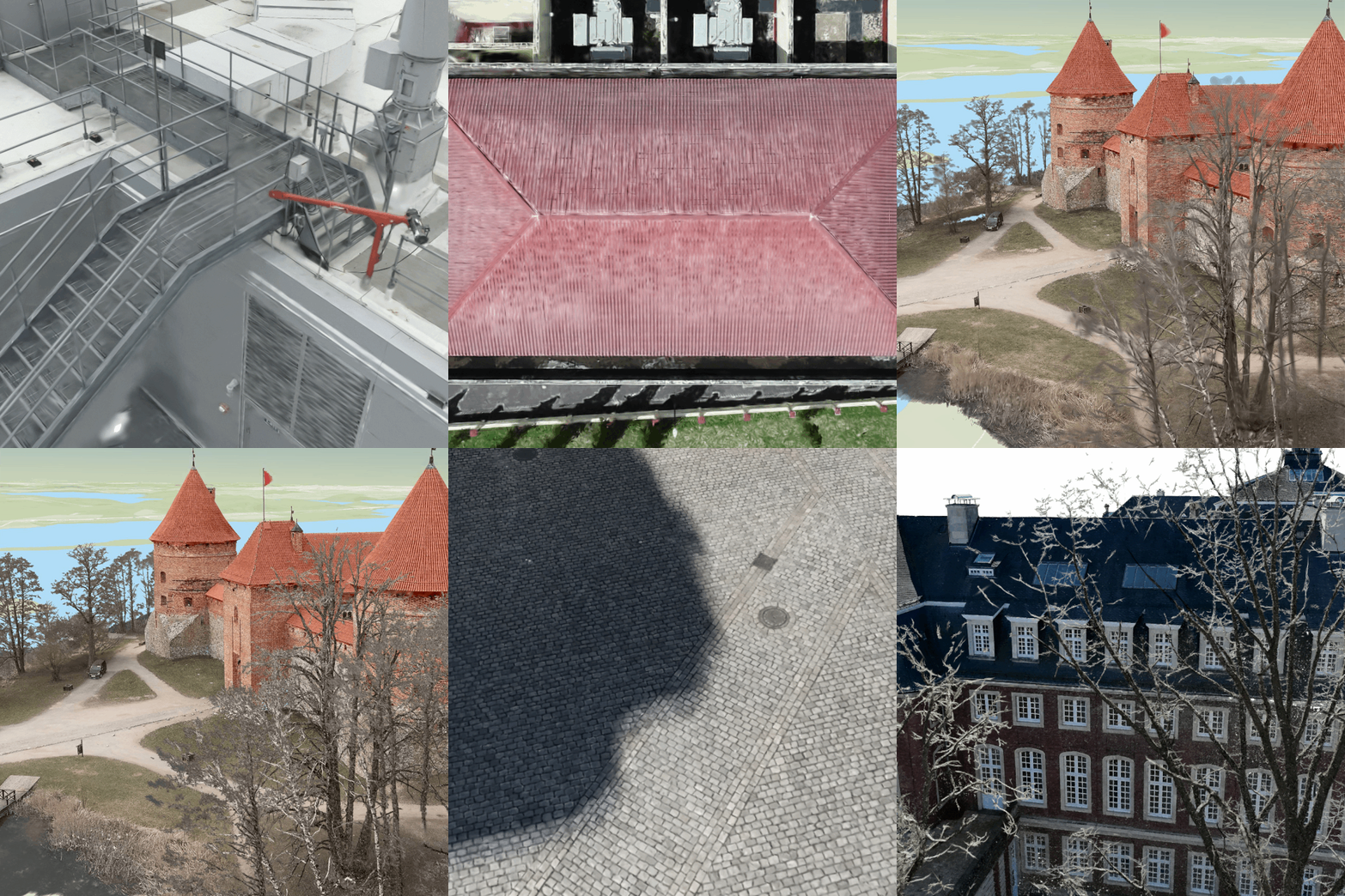
Updates to the Drone2Map processing engine deliver faster processing and improved accuracy, helping teams produce mapping products more efficiently – particularly when working on large or time-sensitive projects. Gaussian splat processing has also been improved, reducing processing times for large datasets while enhancing the fidelity of the resulting 3D representations. The improved Gaussian splats can capture greater detail in thin structures, high-frequency textures, and other complex features.
For projects where detail and dimensional accuracy are critical, these improvements can help teams generate richer and more realistic representations of their environments.
A New Rapid Mode for Time-Critical Projects
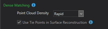
Not every drone mapping project requires the highest possible processing density. In situations where teams need results quickly, processing speed can be just as important as detail. ArcGIS Drone2Map 2026.1 introduces a Rapid point cloud density option designed specifically for these scenarios. By reducing processing times, Rapid mode allows users to create True Orthos and digital surface models more quickly.
This can be particularly useful for:
- Disaster response and emergency management
- Rapid infrastructure inspections
- Active construction projects
- Preliminary site assessments
- Situations where decision-makers need timely spatial information
Rather than waiting for a high-density processing workflow to finish, teams can generate useful mapping products quickly and use them to support immediate decisions.
Better Image Calibration for Challenging Environments
Drone imagery doesn’t always come from ideal conditions. Low-contrast scenes, dense vegetation, and areas with few distinct visual features can make image adjustment and calibration more challenging. To address this, Drone2Map 2026.1 introduces a Challenging adjustment mode.
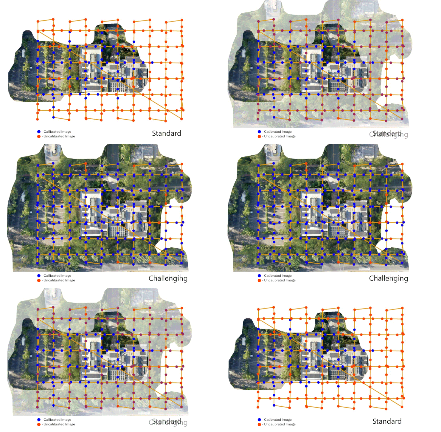
The new option provides greater flexibility when calibrating difficult imagery, helping improve the overall quality of the resulting mapping products.
For organizations operating in complex environments, this means greater confidence when transforming drone imagery into accurate and usable spatial information.
Expanded Support for DJI Thermal Cameras
Thermal imagery provides information that conventional RGB imagery cannot. It can help identify heat patterns, support inspections, and provide additional insight into conditions that may not be visible in standard imagery.
Drone2Map 2026.1 expands DJI thermal camera support to include platforms such as:
- DJI Dock 3
- DJI Zenmuse H30T
- DJI Zenmuse XT S
- DJI Matrice 4T
This enables users to process thermal imagery from supported cameras and generate accurate True Orthos.
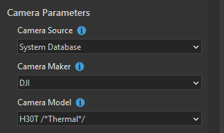
For inspection, infrastructure, environmental monitoring, and other applications that rely on thermal information, this expanded support makes it easier to incorporate thermal drone imagery into established GIS workflows.
Bring Drone Imagery into Immersive 3D Workflows
Drone mapping is no longer limited to producing traditional 2D orthophotos. With Drone2Map 2026.1, projects can now be shared as Oriented Imagery Layers to ArcGIS Online or ArcGIS Enterprise.
When these layers are combined with 3D Mesh or Gaussian Splat layers in a web scene, users can create immersive environments for exploring and inspecting detailed locations.
This opens up opportunities for teams to move from simply viewing drone imagery to interacting with it in a more intuitive 3D environment.
For example, inspection teams can use these workflows to examine detailed structures, while project managers and other stakeholders can explore a site remotely without necessarily being physically present.
Cloud-Optimized Outputs for More Efficient Web Mapping
As drone datasets continue to grow, organizations need efficient ways to store, access, and visualize large raster datasets. Drone2Map 2026.1 modernizes raster output workflows with support for Cloud Optimized GeoTIFF (COG) for merged TIF products.
COG uses internal tiling and overviews to make raster datasets more efficient to access in cloud environments. This can improve responsiveness when working with large imagery datasets.
The release also introduces additional output formats, including:
- Meta Raster Format (MRF)
- Cloud Raster Format (CRF)
These formats are available for products such as True Ortho, DSM, DTM, and Shaded Relief.
The result is a more scalable approach to working with large drone mapping datasets, helping users achieve faster loading and smoother navigation in web-based workflows.
Faster and More Flexible Ground Control Workflows
Ground control points are essential when high positional accuracy is required. However, setting up and processing ground control can become time-consuming, particularly for large projects. Drone2Map 2026.1 introduces improvements designed to make this process more efficient.
Auto link detection is now more than 30 percent faster, reducing the time required to establish links between imagery and ground control points. The release also provides greater flexibility when importing ground control points in a geographic coordinate system. Users can now define their preferred project coordinate system rather than automatically using the nearest UTM zone.
This eliminates unnecessary reprojection steps and can simplify project setup. Where a transformation is required, it can also be applied during the same workflow. For high-accuracy projects, these improvements can help reduce setup time while maintaining the precision required for professional mapping applications.
A Simplified Licensing Model
ArcGIS Drone2Map 2026.1 also introduces changes to licensing through the new Reality Mapping user extension. The updated licensing model provides access to the full range of advanced Drone2Map capabilities while simplifying how licenses are managed across an organization.
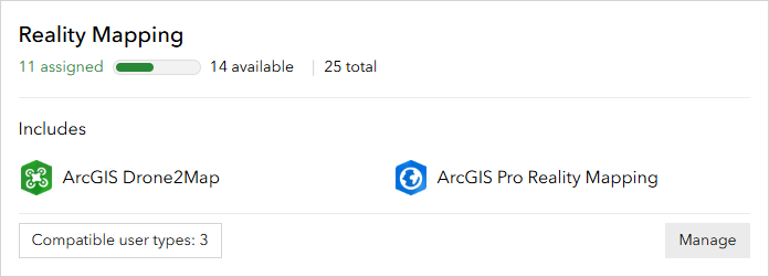
For users assigned a Professional or Professional Plus user type, the previous 300-gigapixel limit for Drone2Map projects is also removed. This is particularly significant for organizations working with large drone datasets. Instead of splitting very large projects into multiple sub-projects because of the previous limit, users can process larger datasets within a single project workflow.
Meet the Drone2Map Assistant
Another notable addition is the Drone2Map Assistant (beta). Designed to reduce workflow friction, the assistant helps users navigate common Drone2Map tasks and simplify project setup through actions. It can also help users find and understand relevant documentation as they work through different workflows.
For both experienced users and those who are still building their Drone2Map skills, an assistant that helps navigate workflows and documentation can make it easier to get started and troubleshoot challenges.
Beginning June 15, users can participate in the Early Adopter Community for the Drone2Map Assistant beta and provide feedback that can help shape its future development.
What Does This Mean for Your Drone Mapping Workflows?
The updates in ArcGIS Drone2Map 2026.1 go beyond individual features. Together, they reflect a broader focus on helping organizations make drone mapping workflows faster, more accurate, scalable, and easier to use.
Whether your organization is responding to an emergency, monitoring a construction site, conducting an infrastructure inspection, producing high-accuracy survey products, or building immersive 3D environments, the latest release provides new capabilities to help you get more from your drone imagery.