Using GIS to Protect Africa’s Wildlife
September 14, 2026 2026-09-14 7:46
Using GIS to Protect Africa’s Wildlife
Africa is home to some of the world’s most remarkable wildlife and ecosystems. From vast savannahs and forests to protected areas that support elephants, lions, rhinos, and countless other species, these landscapes are essential to both biodiversity and local communities. Yet Africa’s natural heritage faces increasing pressure. Poaching, habitat destruction, human-wildlife conflict, and climate change are placing wildlife and ecosystems at risk.
Addressing these challenges requires more than protecting animals in isolation. Conservation needs a holistic approach, one that brings together environmental monitoring, technology, climate action, law enforcement, and data-driven decision-making. One organization demonstrating this approach is Space for Giants, which uses Geographic Information System (GIS) technology to support wildlife conservation and protect some of Africa’s most important natural areas.
Related: A Holistic Approach to Protecting Africa’s Wildlife
Using GIS to Understand Wildlife Movement
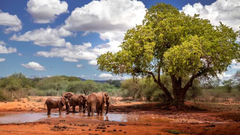
One of the biggest advantages of GIS in conservation is its ability to connect wildlife activity with location. Since its establishment in 2011, Space for Giants has used GIS alongside technologies such as satellite imagery and GPS tracking collars to better understand elephant movements.
By mapping where elephants travel, conservation teams can identify important wildlife corridors and understand how animals interact with their surroundings. These insights can help inform decisions about where conservation resources are needed and where wildlife movement may be at risk. GIS can also reveal patterns that may not be obvious when looking at individual data points. When information is brought together on a map, conservationists can see relationships between wildlife movements, protected areas, human settlements, roads, and potential threats.
Mapping Poaching Risks
Poaching remains a serious threat to wildlife across Africa. Understanding where illegal activities occur is an important part of developing effective conservation strategies. GIS provides conservation teams with tools to map incidents and identify areas where poaching activity may be concentrated. These spatial insights can help teams determine where patrols and other resources can have the greatest impact.
Instead of responding to threats without a clear picture of their location and distribution, conservation organizations can use geographic data to support more targeted and informed action.
Protecting Critical Wildlife Corridors
Wildlife does not recognize the boundaries drawn on maps. Animals often move between protected areas in search of food, water, breeding grounds, and safer habitats. As human settlements, roads, agriculture, and other developments expand, these natural movement routes can become increasingly fragmented.
Mapping wildlife corridors helps conservationists understand the areas that are critical for animal movement. This information can support planning and conservation efforts designed to maintain connectivity between important habitats. For elephants and other wide-ranging species, protecting these corridors can be essential to maintaining healthy populations and reducing conflict between wildlife and surrounding communities.
Using Conservation to Address Climate Change
Climate change presents another major challenge for Africa’s ecosystems. Changes in temperature, rainfall, water availability, and vegetation can affect wildlife and the habitats they depend on. Conservation organizations therefore need approaches that address both biodiversity protection and climate resilience.
Space for Giants has been applying its monitoring expertise to initiatives involving carbon credits. These efforts provide an opportunity to connect conservation and climate action while generating financial resources that can support ongoing environmental protection. This demonstrates how conservation can extend beyond protecting individual species to addressing the broader environmental systems that sustain them.
Turning Location Data into Evidence for Justice
Protecting wildlife also means ensuring that those involved in wildlife trafficking and other environmental crimes can be held accountable. Space for Giants’ wildlife law and justice program uses GIS to support wildlife crime investigations. Geographic information can help investigators understand and map the movement of illegally traded wildlife and identify trafficking routes.
This type of evidence can provide prosecutors with a clearer picture of how wildlife crime networks operate and where illegal activities take place. In this way, GIS becomes more than a conservation planning tool. It can also contribute to the pursuit of justice and the fight against wildlife trafficking.
Why a Holistic Approach Matters
Wildlife conservation is complex. Protecting Africa’s natural heritage requires attention to ecological, social, economic, and legal factors. GIS can help bring these different dimensions together. A single map can connect information about wildlife populations, habitats, human settlements, infrastructure, climate conditions, conservation areas, and threats. When these datasets are analyzed together, they can provide a more complete picture of the challenges facing an ecosystem.
This allows conservation organizations, governments, researchers, and communities to make decisions based on evidence and a better understanding of what is happening on the ground.
Technology for a More Sustainable Future
The future of wildlife conservation will depend increasingly on our ability to understand and respond to changing environments. GIS, satellite imagery, GPS tracking, and other geospatial technologies are giving conservationists new ways to monitor ecosystems, understand wildlife behavior, identify threats, and prioritize action.
The work of organizations such as Space for Giants demonstrates how technology can support conservation beyond simply putting animals on a map. It can help connect data, people, places, and decisions to create more effective strategies for protecting Africa’s natural heritage. As threats to wildlife continue to evolve, a holistic, technology-enabled approach will be essential to ensuring that Africa’s extraordinary landscapes and wildlife can thrive for generations to come.
This story was first published by David Gadsden. View full story here