Did You Know? You Can Collect GIS Data Using Your Smartphone
November 2, 2026 2026-11-02 12:57
Did You Know? You Can Collect GIS Data Using Your Smartphone
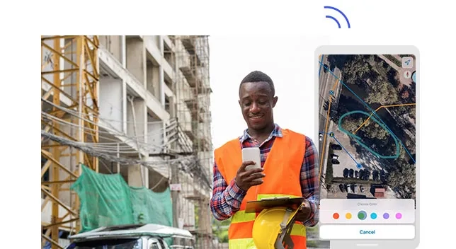
From capturing field observations to updating geographic information, your smartphone can become a powerful GIS data collection tool.
Collecting geographic data no longer has to involve bulky equipment, paper forms, or lengthy manual processes. With ArcGIS mobile apps, field teams can use smartphones and tablets to capture location-based information, update existing records, and share data with their organizations.
Whether you are monitoring infrastructure, conducting surveys, managing natural resources, or inspecting assets, mobile GIS makes it easier to bring field information into your organization’s geographic information system.
Turning Your Smartphone into a GIS Tool
Smartphones are equipped with GPS and location services that can help capture geographic information. When combined with ArcGIS mobile applications, they become practical tools for field data collection.
Esri offers several mobile applications designed to support different field workflows:
- ArcGIS Field Maps: A mobile application that allows field teams to view maps, collect and edit geographic data, and inspect assets.
- ArcGIS Survey123: A form-based data collection application that supports surveys with questions, photos, GPS locations, and other information.
- ArcGIS QuickCapture: A rapid data collection application that uses simple buttons to capture field observations with minimal interaction.
Each application supports different workflows, allowing organizations to choose the tools that best suit their field activities.
Collect Data Even Without Internet Connectivity
Fieldwork often takes place in remote locations where internet access is unreliable or unavailable. Fortunately, supported ArcGIS mobile workflows can operate offline.
Field teams can download maps and prepare their data collection projects before heading into the field. They can then collect information, record observations, and update data while disconnected.
Once connectivity is restored, collected information can be synchronized with the organization’s GIS, making updates available to other authorized users.
This capability is particularly valuable for teams working in rural areas, conservation sites, construction projects, and other locations with limited connectivity.
From Field Data to Actionable Insights
Collecting data is only one part of the process. The real value comes from making that information available for analysis and decision-making.
ArcGIS mobile data collection workflows can connect field observations to maps, dashboards, and other GIS applications. This helps organizations bring field information into their wider operational workflows.
For example, field teams can use mobile GIS to:
- Record infrastructure conditions and maintenance requirements.
- Conduct inspections and update asset information.
- Capture environmental observations and conservation data.
- Collect survey responses and community feedback.
- Monitor project activities and geographic changes.
With field information integrated into GIS, organizations can improve visibility into their operations and make more informed decisions.
How Accurate Is Smartphone GPS?
Smartphones can capture geographic locations, but accuracy varies depending on the device, environmental conditions, and available location signals.
For applications requiring higher positional accuracy, compatible external GNSS receivers can be connected to mobile devices to improve location measurements.
Organizations should therefore select their devices and data collection workflows according to their accuracy requirements.
Start Collecting Data in the Field
Mobile GIS is helping organizations simplify fieldwork, improve data collection, and connect field teams with office-based operations.
With ArcGIS mobile applications, your smartphone can become more than a communication device. It can be a valuable tool for capturing geographic information and supporting better decisions.
Ready to explore mobile GIS? Discover how ArcGIS Field Maps, Survey123, and QuickCapture can support your field data collection workflows.
Learn more about ArcGIS Field Maps, ArcGIS Survey123, and ArcGIS QuickCapture.