Beyond the Map: An Interview with Eunice Waweru on Geospatial Insight and Human-Centered Innovation
July 21, 2025 2025-07-21 11:54Beyond the Map: An Interview with Eunice Waweru on Geospatial Insight and Human-Centered Innovation
Beyond the Map: An Interview with Eunice Waweru on Geospatial Insight and Human-Centered Innovation
This week, we speak with Eunice Wairima Waweru, a Geospatial Engineering graduate from the University of Nairobi and an emerging thought leader passionate about spatial intelligence, sustainability, and innovation in Africa’s extractives sector. Eunice takes us through her personal journey, her work in Kenya’s mining industry, and how her internship with Esri Eastern Africa sparked a new vision for transforming spatial data into strategic insight.
Q: Eunice, tell us a bit about who you are and what drew you to geospatial work.
Eunice: I’m a detail-oriented, science-intrigued person who thrives on conversations that spark curiosity and ideas. My personality is reflective yet analytical, calm yet inquisitive, something that blends almost poetically with geospatial work. Much like a well-crafted map, I’ve always felt drawn to what lies beneath the surface, to patterns, meaning, and connections that aren’t immediately visible but are deeply important.
Q: You’ve had experience working in Kenya’s mining sector. What insights did that bring to your geospatial journey?
Eunice: It was an eye-opener. I saw first-hand how critical gaps in spatial data accessibility and resource visibility were holding the sector back. Despite the vast mineral potential across the country, decision-makers and investors often lacked the intuitive tools needed to understand, explore, and market these resources effectively. That experience stayed with me, it became the seed for a bigger solution.
Q: And that solution began to take shape during your internship at Esri Eastern Africa. Tell us more about that.
Eunice: Yes, during my time at Esri Eastern Africa, I started putting ideas into action. One of the highlights was designing a StoryMap focused on strategic mineral resources in Dabel, Moyale. It wasn’t just a project, it felt like a prototype for a national mineral marketing platform. I saw how spatial storytelling could power a shift in how Kenya showcases its mining potential to investors, policy-makers, and communities.
Q: What Esri tools have become part of your workflow, and how do you see them shaping the future of the mining industry?
Eunice: I’ve worked with ArcGIS Dashboards, Experience Builder, ArcGIS Field Maps, Survey123, ArcGIS Hub, Web AppBuilder, and ArcGIS Pro, among others. These tools aren’t just for mapping, they’re for streamlining data collection, enabling real-time field intelligence, supporting transparent reporting, and enhancing investor engagement. I envision a future where Kenya’s mining sector uses these platforms to operate more efficiently, communicate more clearly, and grow more sustainably.
Q: What excites you most about Esri’s technology and its broader applications?
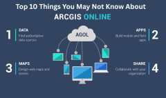
Eunice: What truly captivated me was seeing the real-world impact of ArcGIS. It’s more than just a set of tools, it’s a catalyst for clarity, connection, and change. Whether it’s through dashboards that simplify complex systems or using ArcGIS Online to share meaningful insights, Esri’s technology moves data from static to strategic. I’ve come to see location intelligence not just as a skill but as a mindset.
Q: You’ve mentioned your interest in areas like the SDGs, digital twins, and smart cities. How do these intersect with your work?
Eunice:
These areas are incredibly exciting to me because they demonstrate how GIS can power living systems that support adaptive planning, sustainability, and resilience. When we talk about smart cities or digital twins, we’re really talking about data-driven ecosystems. And when GIS is at the center, we can align local efforts with global goals like the Sustainable Development Goals (SDGs) in ways that are measurable and meaningful.
Q: You clearly bring a human-centered approach to your work. Can you speak to that?
Eunice: Yes, always. Even when I’m knee-deep in code or analyzing layers of spatial data, I remind myself that behind every feature on a map is a human story. I work with a sensitivity to context, culture, and equity. For me, geospatial work isn’t just about the where, it’s also about the why, the how, and the what next. That mindset keeps my work grounded and purposeful.
Final Thoughts
Eunice Wairima Waweru is a rising voice in the geospatial field, combining technical precision with visionary thinking and deep empathy. Her journey is a testament to how geospatial technology, when paired with intention and insight, can do more than map the world—it can reshape it.
For more stories like this, subscribe to our weekly newsletter and stay inspired. https://www.linkedin.com/newsletters/archabari-7098197270361178113/

