Recording Multiple Geometries in a Single Survey with ArcGIS Survey123
September 5, 2025 2025-09-05 8:38
Recording Multiple Geometries in a Single Survey with ArcGIS Survey123
Imagine you work for a national park and need to collect data on trees, bushes, hedges, and terrains across the park. Or perhaps you’re at a school and want to map fences and playing fields around the campus. In both cases, having a single survey that can capture points, lines, and polygons would make your work much simpler.
However, if you try to set this up in ArcGIS Survey123, you may encounter the following warning:
“Feature layers in ArcGIS can only store one geometry type.”
This happens because Survey123 submits data to a single feature layer, which can only hold one geometry type at a time. Don’t worry, with a few extra steps in Survey123 Connect, you can set up your survey to capture multiple geometries seamlessly.
What is Survey123 Connect?
Think of Survey123 Connect as the more customizable, desktop-based cousin of Web Survey123. It’s a separate application that links to your ArcGIS Online account, allowing you to open and enhance surveys initially created in the web version.
A useful approach is to first create the basic structure of your survey in Web Survey123, then open it in Connect to add more advanced functionality.
Using Repeats to Capture Multiple Geometries
The secret to recording points, lines, and polygons in a single survey is the Repeat function in Survey123 Connect.
Repeats allow you to capture multiple entries for a specific set of questions. For example, in a household survey, you might record the address and general information for the household, but also want to record details for each individual member, such as name, age, and occupation.
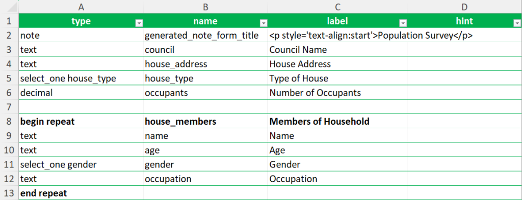
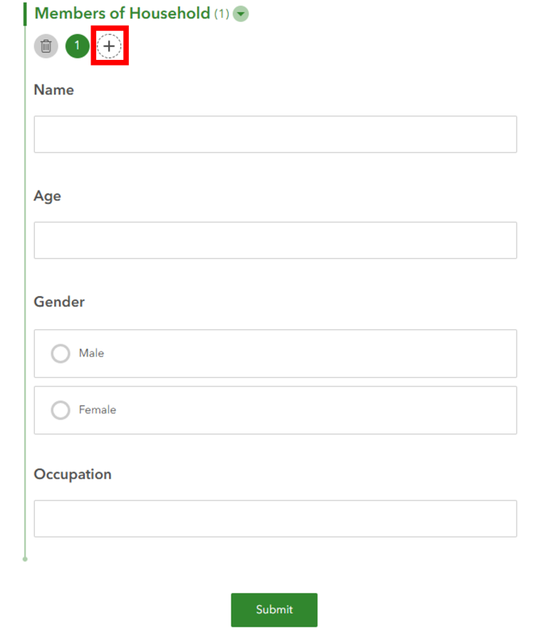
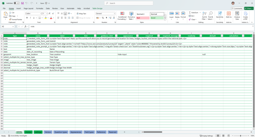
In Survey123 Connect, you implement repeats by placing begin repeat and end repeat around the questions you want to repeat. Once configured, survey users can add multiple entries using the plus (+) icon.
Repeats are stored in related tables that link back to the main survey feature layer. This setup is what allows you to record multiple geometry types in one survey.
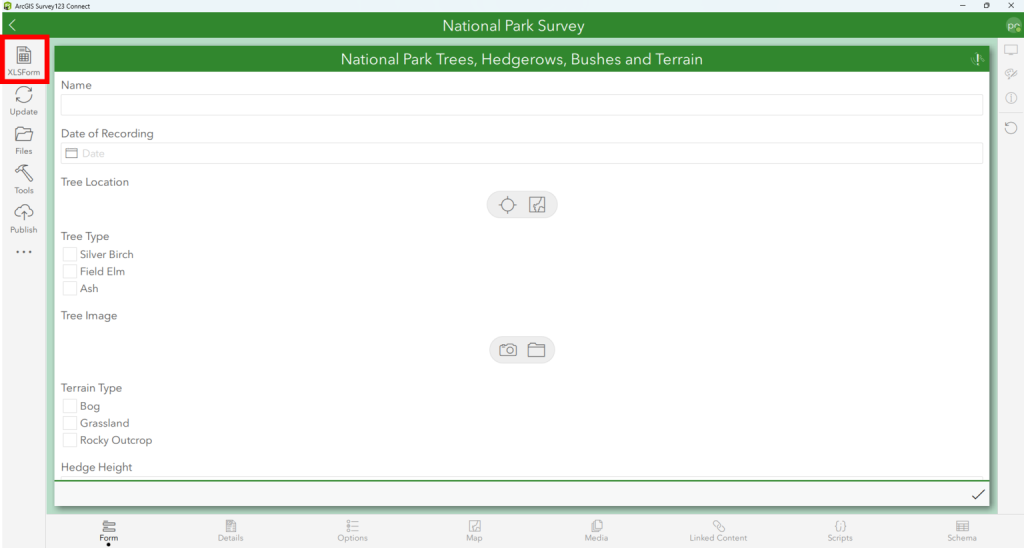
Example: National Park Survey
To illustrate, I created a survey to capture:
- Trees → Points
- Hedges → Lines
- Bushes → Polygons
- Terrain → Polygons
After building the main survey in Web Survey123, I added the geometry questions in Connect and configured repeats to handle each geometry type.
How Recorded Data Appears
After collecting some sample data, the Data section in Web Survey123 shows:
- One main survey table (storing general info like name, date, etc.)
- Four repeat tables (storing trees, hedges, bushes, and terrain geometry)
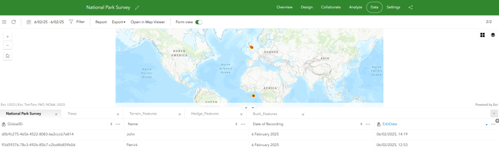
The repeat tables link back to the main survey using Unique Identifiers. Each survey submission has a GlobalID, and the repeat entries connect via a matching ParentGlobalID.

You may notice random points appearing off the coast of Africa — this happens when the main survey doesn’t include a geometry question. Survey123 automatically creates a feature layer for the survey data in this case.
Tips for Survey Design
Understanding the relationship between the main survey and repeat tables is key. Depending on your data structure, you may want to:
- Include a geometry question in the main survey as a “container” for all repeat geometries (e.g., a polygon defining the park area).
- Use an ID system to relate all survey inputs to a specific feature (e.g., a park ID selected before recording new features).
If you’ve struggled with recording multiple geometries in Survey123, using repeats in Survey123 Connect offers a practical solution. If you’re new to Connect, this approach provides a great introduction to its advanced capabilities. For more information on how you can purchase ArcGIS Survey 123, Visit our online store.