Expanding Education and Career Opportunities
July 6, 2022 2022-07-15 9:11
Expanding Education and Career Opportunities
By striking a balance between technical skills and conceptual understanding, GIS equips the students with real-world, interdisciplinary problem-solving skills. This prepares them to branch out into different career paths according to their aspirations.
Global connectivity is rising as a result of spatial perspective for comprehending the broad picture. Today, different fields employ geographic data, including disaster management, city planning, crime, archaeology, health, transportation, and education. GIS framework supports the entire process of gathering, storing, and analyzing location intelligence to produce dynamic maps that assist people and organizations in making informed decisions.
GIS produces spectacular visualizations and has established itself as a crucial tool for problem-solving and well-informed decision-making by integrating real-time data, potent analytical tools, interactive maps, and field gathering tools. Over the years, GIS has become an efficient educational administration tool.
GIS can be used by administrators in the educational sector to visualize every element of administration, from tracking campus safety to planning infrastructure and scheduling school vehicles. They can use spatial data to map campus buildings, pinpoint risky locations, plan recruitment campaigns, and even decide when to open and close educational institutions. When deciding where to implement new educational initiatives and for identifying trends in educational success, educational policymakers find great value in employing GIS-based maps.
Today, all disciplines, including geography, history, language, chemistry, mathematics, biology, environmental studies, and many more, may give interactive content thanks to GIS. Visual learning is more effective for students of all ages, which is one of the main causes of the rising use of GIS to provide course material.
GIS is used in higher or professional education settings to assist students develop as effective analysts and decision-makers by tying spatial tactics to practical business principles. GIS facilitates research by fostering a welcoming environment for students to engage with the neighborhood businesses. Students are capable of carrying out thorough research inquiries and making persuasive recommendations.
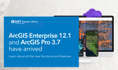
GIS can improve student spatial literacy. If you’re an education policy maker looking to embrace GIS in your institution, visit our online store to make a purchase of ArcGIS products.